 Sofia Rossi
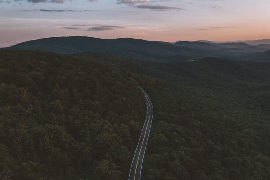
Cycling Skyline Drive is absolutely possible, and the National Park Service rules are refreshingly clear: road bikes, mountain bikes and all classes of e-bikes are allowed on Skyline Drive and every paved area in Shenandoah National Park, and almost nowhere else. The 105 mile ridge road from Front Royal to Rockfish Gap, with about 75 overlooks, a 35 mph speed limit and well over 11,000 feet of total climbing in the usual route counts, is a serious but achievable multi day ride when you split it at the park gaps and base a support vehicle, or a Staunton finish, around it. Ride single file, carry lights, start segments early, and pace the week in three or four climbing days rather than one heroic century. This guide breaks down the segments, the support points, the Staunton base logistics and the recovery pacing for an active Skyline cycling trip.
Quick Facts
- Route: Skyline Drive, Shenandoah National Park, Virginia, 105 miles, or 105.5 miles in the park service history, from Front Royal, mile 0, to Rockfish Gap, mile 104.6, along the Blue Ridge crest.
- Entrances: Four: Front Royal (North, mile 0), Thornton Gap (mile 31.5), Swift Run Gap (mile 65.5) and Rockfish Gap (South, mile 104.6).
- Where bikes are allowed: Skyline Drive and all paved areas, plus about one mile of the gravel Rapidan Fire Road near Big Meadows to a signed turnaround, per the National Park Service. No trails, no grass, no other unpaved roads.
- Entry fee for cyclists: 15 dollars per person aged 16 and over entering on foot or by bicycle, valid 7 days; 30 dollars per private vehicle and 55 dollars for the Shenandoah annual pass. The park is cashless, card or mobile payment only, since July 1, 2025.
- Core rule: Ride single file at all times. Federal regulations require it in Shenandoah even where Virginia law has changed, per the park service biking page. Move right to let vehicles pass and pull over when several are stacked behind you.
- Character: A two lane road with steep hills, numerous blind curves and frequent heavy fog, per the park service. Individual grades rarely exceed about 6 to 7 percent, but the climbing is near continuous, with around 75 overlooks for rest stops.
- Highest point: About 3,680 feet on Skyline Drive, with Hawksbill, the park highest summit at over 4,000 feet, reached on foot from the road.
- Support: Visitor centres and waysides at Dickey Ridge (mile 4), Harry F. Byrd Sr. at Big Meadows (about mile 51), and Loft Mountain (about mile 79), plus lodges at Skyland (about mile 42) and Big Meadows (about mile 51), campgrounds, and bike repair stations at several locations in the park.
- No in park shuttle: There is no public transport inside the park. Support means your own vehicle, a partner driving leapfrog, or pre arranged pickups at the gaps.
How should you split Skyline Drive into rideable segments?
The gaps are the gift of this road. Four entrances cut the 105 miles into three natural riding days, and the mileposts, counted from Front Royal southward, make navigation a matter of arithmetic. Segment one, Front Royal to Thornton Gap, miles 0 to 31.5, is the wake up call: the road climbs from the Shenandoah Valley floor onto the ridge, passes the Dickey Ridge Visitor Center at mile 4, rolls over Hogback Overlook and through the Marys Rock Tunnel, a 670 foot bore through granite finished in 1932, and drops to Thornton Gap and Route 211. It is a full mountain day in 31 miles, and it tells you honestly what your legs have for the rest.
Segment two, Thornton Gap to Swift Run Gap, miles 31.5 to 65.5, is the high heart of the park. It holds Skyland, the park highest resort area at about mile 42, the climb toward Hawksbill and Stony Man, and Big Meadows at about mile 51, the broad, wildlife rich clearing with a lodge, campground, wayside and the Harry F. Byrd Sr. Visitor Center. At 34 miles with the biggest sustained climbing, this is the day to start earliest and protect most carefully, with Big Meadows as a genuine mid ride refuel rather than a photo stop.
Segment three, Swift Run Gap to Rockfish Gap, miles 65.5 to 104.6, is the longest at 39 miles and in some ways the kindest: the South District rolls more gently, Loft Mountain at about mile 79 offers a campground and wayside, overlooks open east toward the Piedmont as often as west to the valley, and the road finally unwinds to Rockfish Gap, Route 250 and Interstate 64, where Waynesboro sits below and Staunton lies a short drive west. Strong riders combine segments, and very strong riders do the whole drive in two days. Almost nobody should plan it in one unless a supported century over repeated 6 percent grades is already their normal weekend.
What are the rules and hazards that actually matter?
The park service biking page is short enough to memorise, and every line earns its place. Bikes, including all e-bike classes, belong on Skyline Drive and paved surfaces only, with the single gravel exception of about a mile of Rapidan Fire Road at Big Meadows. Riding is single file at all times, a federal rule that overrides the recent Virginia changes. Ride right, ride predictably, be visible, and when vehicles stack up behind you on a climb, pull into an overlook and let them clear. Virginia laws on bike lights and brakes apply in the park, and on a road famous for fog, a bright rear light is not optional equipment.
The hazards are the road virtues inverted. The same ridge that gives 75 overlooks gives blind curves, and the same elevation that cools the air breeds fog banks that can cut visibility to metres, especially in the morning and in autumn, when the park service also warns of heavy traffic. Wildlife is a genuine riding hazard here: deer graze the road edges at dawn and dusk, and black bears cross the drive. Descend at a speed that assumes an animal or a stopped car around every bend, carry more water than the mileage suggests, because ridge sources are the waysides and visitor centres and nothing between, and check the park current conditions before every segment, since winter and storm closures close the drive to everyone, bikes included. For the wider entry picture, the park reservations explainer in the guide to US national park reservations in 2026 sets Shenandoah fee and pass in national context, and cold weather riders can borrow layering logic from the Banff winter guide, where mountain weather runs the schedule.
How does support work, and why Staunton?
There is no shuttle to bail you out, so support is a design problem you solve before day one. The classic solutions, in ascending order of independence: a partner or friend driving the road and meeting you at agreed mileposts, which converts every overlook into a potential feed stop and every gap into a clean overnight exit; a two car shuffle between your group, parked at segment ends; or a fully self supported ride using the park lodges and campgrounds, Skyland and Big Meadows in the middle of the route, Lewis Mountain cabins and the Loft Mountain and Mathews Arm campgrounds, with food carried between waysides. Bike repair stations exist at several points in the park, per the park service, but they are a supplement to, not a substitute for, tubes, a pump and a multi tool in your pocket.
Staunton is the southern base that makes the finish feel like a destination rather than an exit. It is a handsome, walkable Shenandoah Valley town west of Rockfish Gap, with the dining, bike shop support and soft beds a three day climbing trip ends up wanting, and it is also the practical rail and road hub for the valley end of the park. The working pattern: sleep in Front Royal or Luray before segment one, use Thornton Gap and Swift Run Gap, with Luray, Sperryville and Elkton below them, as the overnight exits, and finish into Staunton for the last night and the celebration dinner. Book valley lodging and any vehicle support before park lodging sells the illusion that you can improvise: in peak foliage season, roughly mid October, everything on and below this ridge fills.
How should an active traveller pace the whole trip?
Four days is the sweet spot for a fit recreational rider: a travel and shakeout day with a short Dickey Ridge spin, then the three gap to gap segments on days two, three and four, riding early to beat both fog burn off traffic and afternoon storms, and finishing each day by mid afternoon. Three days works by folding the shakeout into segment one. Either way, build recovery in deliberately: the short hikes are the active recovery, Dark Hollow Falls from Big Meadows, a mile and a half of trail to a 70 foot cascade, Limberlost near Skyland, or the stroll to an overlook at sunset, legs moving gently, no bike involved.
Season choice is the last lever. Spring, April and May, brings wildflowers, long light and thinner traffic, with cold ridge mornings. Summer is green, busy and storm prone. Autumn is the famous one, with foliage colour rolling down the ridge through October, the heaviest traffic of the year, and the park service own warning to cyclists about fall crowds. Winter riding happens only when the drive is open, which ice and snow decide week by week. Choose spring for riding quality, autumn for spectacle, and in either season, let the mileposts, not your pride, set each day length.
Frequently Asked Questions
Can you cycle the whole of Skyline Drive?
Yes. Bicycles, including all e-bike classes, are permitted on Skyline Drive for its full 105 miles, per the National Park Service. Most riders split it at Thornton Gap and Swift Run Gap into three days of about 31, 34 and 39 miles, because total climbing exceeds 11,000 feet in standard route counts.
How much does it cost to enter Shenandoah by bike?
15 dollars per person aged 16 and over entering by bicycle or on foot, valid for 7 consecutive days. A support vehicle pays 30 dollars, and the Shenandoah annual pass is 55 dollars. The park has been fully cashless since July 1, 2025, so bring a card or mobile payment.
Are bikes allowed on Shenandoah trails?
No. The park service permits bikes on Skyline Drive and all paved areas, plus about one mile of the gravel Rapidan Fire Road at Big Meadows to a signed turnaround. Trails, grass and all other unpaved roads are closed to bikes, so the park 500 miles of hiking trails are for your rest day legs, on foot.
Do cyclists have to ride single file?
Yes, at all times. The park service states that despite recent changes to Virginia law, federal regulations require single file riding in Shenandoah National Park. Riders should also move right to let motorists pass and pull over when several vehicles are waiting behind.
Where can we eat, refill and sleep along the ride?
At the park developed areas: Dickey Ridge Visitor Center at mile 4, Skyland Resort around mile 42, Big Meadows lodge, wayside and visitor centre around mile 51, and Loft Mountain around mile 79, with campgrounds at Mathews Arm, Big Meadows, Lewis Mountain and Loft Mountain. Between them there is nothing, so carry water and food for each full segment.
When is the best season to cycle Skyline Drive?
Spring and autumn. April and May offer wildflowers and lighter traffic; September and October offer foliage, peaking around mid October, with the heaviest traffic and fog risk of the year. Summer brings heat in the valleys and afternoon storms. Winter depends on whether the drive is open at all.