 Jordan Ellis
For a first visit, do Capitol Reef in this order: start at the visitor center on Utah Highway 24, walk the Fruita historic district and its orchards while the light is still soft, hike Hickman Bridge before the small trailhead car park fills, and save the fee paid Scenic Drive, with its Grand Wash and Capitol Gorge spur roads, for last, when you know the weather is holding. That sequence matters because most of the park along Highway 24 is free to enter, the orchards and the bridge sit on that free corridor, and the one part that costs money, the 7.9 mile Scenic Drive, is also the part most likely to close after rain. Book nothing else until those three pieces are settled: a base in Torrey, a full day rather than a drive through, and an early start.
Quick Facts
- Where: South central Utah, along Utah Highway 24, with the gateway town of Torrey just west of the visitor center.
- Park hours: The park is open 24 hours a day, year round. Visitor center hours change by season, so confirm them on the National Park Service site before you go.
- Scenic Drive fee: $20 per vehicle for the Scenic Drive, paid at a self pay station just south of Fruita Campground. Holders of America the Beautiful passes are covered. Driving Highway 24 itself carries no fee.
- Scenic Drive length: 7.9 miles (12.7 km) of paved road, one way, plus dirt spur roads into Grand Wash and Capitol Gorge. Allow about an hour and a half for the round trip with stops.
- Signature hike: Hickman Bridge, 1.8 miles round trip, a moderate climb of about 400 feet to a natural bridge 133 feet across.
- Road conditions line: Call 435-425-3791 and follow the prompts for current road conditions before driving any dirt road.
- Best base: Torrey, for lodging and food a short drive from the visitor center, or Fruita Campground inside the park for campers who book ahead.
Why does the order of a first day matter so much here?
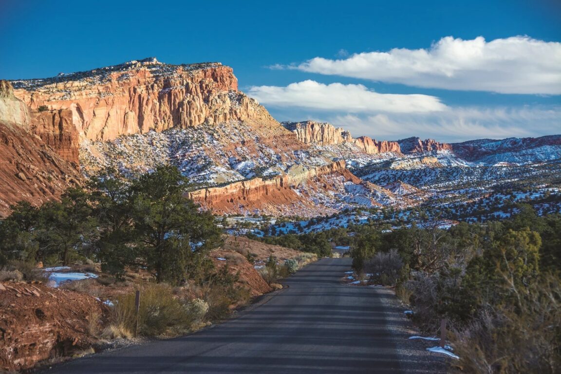
Capitol Reef is not built like Zion or Bryce Canyon. There is no single entrance station and no shuttle system. The park is long and narrow, wrapped around the Waterpocket Fold, a wrinkle in the earth about 100 miles long where rock layers were pushed up roughly 6,800 feet higher on the west side, according to the National Park Service geology tour of the Scenic Drive. Highway 24 cuts across the Fold and passes the visitor center, the Fruita district, the petroglyph panels and the Hickman Bridge trailhead in one short, free corridor. Everything a first timer most wants sits along or just off that corridor, which is why the day works best as a corridor day first and a back road day second.
The second reason is weather. The Scenic Drive and its spur roads can close for snow, ice, mud and flash floods, and the dirt roads into Grand Wash and Capitol Gorge turn quickly after storms. The National Park Service is explicit that visitors should check at the visitor center or call the recorded road conditions line before setting out. If you build the day around the free, paved, always accessible pieces first, a closure costs you an add on rather than the whole visit.
What should you do in Fruita before anything else?
Fruita is the settled heart of the park, a pioneer farming community planted along the Fremont River in the late 1800s, and it is the easiest place in Utah’s national parks to slow down. The historic district holds the one room Fruita schoolhouse, the Gifford House store and museum, a historic barn, and orchards that the Park Service still maintains as part of the cultural landscape. In harvest season, visitors may walk into unlocked orchards, pick ripe fruit and eat it in the orchard at no charge, paying at self pay stations only for fruit they carry out. Which orchard is open, and which fruit is ripe, changes week by week from early summer cherries through autumn apples, so ask at the visitor center that morning rather than planning around a single crop.
Give Fruita a unhurried hour at the start of the day. The Gifford House, known for fresh baked pies and local preserves, operates seasonally, roughly from spring into late autumn, so treat it as a bonus rather than a plan in November and confirm opening at the visitor center. Walk the Fremont River path, read the orchard signs that explain how this desert valley was irrigated, and use the stop to fill water bottles and check the day’s road and trail notices. Fruita Campground, the park’s only developed campground with 71 sites set among the orchards, is reservable through Recreation.gov and fills far ahead in spring and autumn, which is the single booking a camper needs to make before anything else.
How hard is the Hickman Bridge hike, really?
Hickman Bridge is the right first hike in the park: short enough for a half day visit, high enough to teach you the geology, and finished with a payoff that needs no explanation. The trail leaves from a trailhead on Highway 24 about two miles east of the visitor center and climbs in switchbacks above the Fremont River before levelling into a wash and arriving beneath a natural bridge that spans 133 feet. The round trip is 1.8 miles with about 400 feet of climbing, rated moderate, and most walkers finish it in one to two hours. Go early. The car park is small, the first climb has little shade, and the bridge photographs best before midday crowds arrive.
Two practical notes belong in every first timer plan. First, there is no water on the trail and very little shade after the river section, so carry water even for a short morning hike, a habit that matters everywhere in this park. Second, the same trailhead serves the longer Rim Overlook and Navajo Knobs routes, so follow the signed Hickman Bridge fork carefully rather than drifting onto the bigger day by accident. On the way back down, stop at the Fremont petroglyph panels on Highway 24, a short boardwalk stop that adds the human story of this canyon to the morning at almost no cost in time.
When should you drive the Scenic Drive, and what does the fee actually buy?
Drive the Scenic Drive after Fruita and Hickman Bridge, ideally in the long light of the afternoon, and only after checking conditions. The road runs south from the visitor center for 7.9 paved miles along the face of the Waterpocket Fold. The $20 per vehicle fee is collected at a self pay station just south of the campground, and America the Beautiful pass holders do not pay again. What the fee buys is the park’s best geology lesson: a signed route past the Moenkopi and Chinle formations, the Oyler uranium mine openings at the mouth of Grand Wash, and the Slickrock Divide, with two dirt spur roads that do the real work. Grand Wash leads to the Cassidy Arch trailhead and a flat walk between narrowing walls. Capitol Gorge follows the route wagons used until Highway 24 was paved, ending at the Pioneer Register, where travellers recorded their names on the canyon wall.
Both spur roads are usually passable to ordinary passenger cars and to RVs up to the length limits the Park Service posts, but that word usually is doing heavy lifting. After rain, the same roads can be closed or impassable, and flash floods can arrive in these canyons under a blue sky overhead if storms are upstream. Never enter Grand Wash or Capitol Gorge when storms threaten, and treat the visitor center’s morning briefing as part of the ticket price. Drivers comparing Utah parks should also read our guide to US national park reservations in 2026, which explains why Capitol Reef, with no timed entry system, rewards early starts rather than advance permits.
Where should you stay, and how many nights does a first visit need?
One full day covers the corridor properly: visitor center, Fruita, Hickman Bridge, the petroglyphs and the Scenic Drive with both spurs. Two days is the better first visit, because it leaves room for a second hike, such as Cassidy Arch or Cohab Canyon above Fruita, and for the Burr Trail or Cathedral Valley only if conditions and vehicle clearance genuinely suit them. Most visitors sleep in Torrey, a few minutes west of the park, where motels, lodges and restaurants cluster along Highway 24, with more options in the wider Wayne County area. Campers who want to wake up inside the orchards should book Fruita Campground the moment dates are fixed. For a desert stay with a very different budget, see our profile of Amangiri in southern Utah, and use it as a contrast rather than a base, since it sits hours from Capitol Reef.
Prices checked and park details verified against the National Park Service on November 18, 2026. Fees, visitor center hours and road status change with season and weather, so recheck the park’s alerts page and recorded line on the day you travel.
Frequently Asked Questions
Is Capitol Reef free to enter?
Mostly, yes. Driving Utah Highway 24 through the park, visiting Fruita, the petroglyph panels and the Hickman Bridge trailhead carries no entrance fee. The fee applies to the Scenic Drive beyond Fruita Campground: $20 per vehicle, with America the Beautiful passes accepted.
How long does the Scenic Drive take?
The National Park Service suggests about an hour and a half for the round trip, including the Grand Wash and Capitol Gorge spur roads. Add time if you walk into either canyon, and do not start it late if storms are forecast.
Can you really pick fruit in the Fruita orchards?
Yes, in season and only in orchards posted as open. Fruit eaten inside the orchard is free; fruit you take away is weighed and paid for at self pay stations. The open orchards and ripe crops change weekly, so ask at the visitor center on the day.
Is Hickman Bridge suitable for children?
For children used to walking, yes, with supervision. It is 1.8 miles round trip with about 400 feet of climbing, no water and little shade, so start early, carry water for everyone, and keep children close on the switchbacks above the river.
Do you need a high clearance vehicle for a first visit?
No. The visitor center, Fruita, Hickman Bridge and the paved Scenic Drive suit ordinary cars, and the Grand Wash and Capitol Gorge spurs are usually passable to passenger vehicles in dry conditions. Cathedral Valley and the park’s remote dirt roads are a different trip and do need clearance, current advice and a full day.
What should you do if the Scenic Drive is closed?
Do the free corridor well instead: Fruita, the petroglyphs, Hickman Bridge and the short walks along Highway 24, then ask rangers which overlooks and trails they recommend that day. A closure is information, not a ruined visit, and the corridor holds a full day on its own.