 LeVar Thomas
Auckland’s City Rail Link is open, and for a first time visitor the change is simple: trains no longer end at Waitemata Station in the city centre, they run through it. Passenger services began on Sunday 13 September 2026, after a formal opening on 11 September, using 3.45 kilometres of twin tunnels to link Waitemata with Maungawhau, with two new underground stations in between at Te Waihorotiu and Karanga-a-Hape. That turns a dead end terminus into a through route, joins the former Eastern and Western lines into one cross city service, and puts midtown and Karangahape Road on the rail map for the first time.
Quick Facts
- What opened: The City Rail Link, twin tunnels 3.45 km long and up to 42 m underground, between Waitemata Station and Maungawhau Station
- Opening dates: Formally opened 11 September 2026; public passenger services began Sunday 13 September 2026, first weekday timetable Monday 14 September 2026
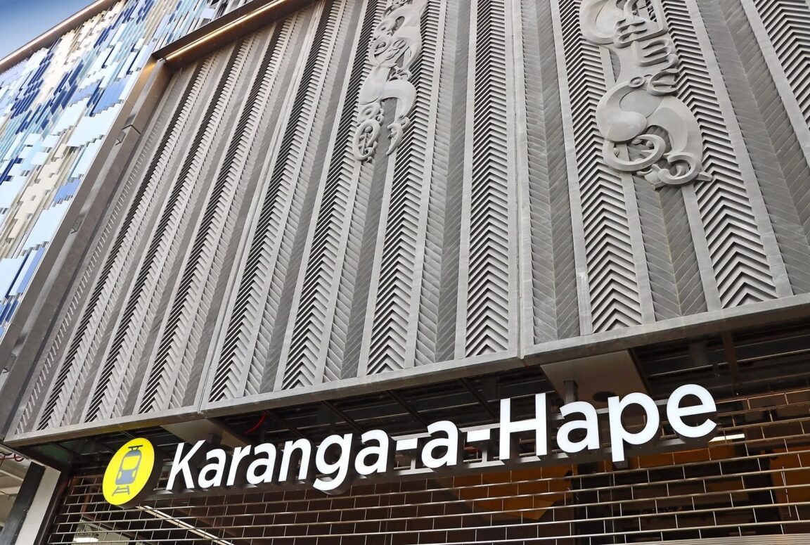
- New stations: Te Waihorotiu in midtown near Aotea Square, and Karanga-a-Hape with entrances at Mercury Lane and Beresford Square
- Changed station: Waitemata, formerly Britomart, redeveloped from a terminus into a two way through station; Maungawhau replaces the old Mount Eden station as the western interchange
- New line names: East West Line, South City Line and Onehunga West Line replace the former Eastern, Western, Southern and Onehunga lines
- Operators and owners: Infrastructure handed over at the end of June 2026 by City Rail Link Limited to Auckland Transport and KiwiRail
- Where to check live times: Auckland Transport Journey Planner and the AT Mobile app
What exactly opened on 13 September 2026?
Auckland Transport confirms that the City Rail Link opened to passenger services on Sunday 13 September 2026. City Rail Link Limited, the company that built the project, describes it as New Zealand’s largest transport infrastructure project ever, and records practical completion and handover to Auckland Transport and KiwiRail at the end of June 2026. The tunnels themselves are only part of the story. The project also redeveloped Waitemata into a through station, built the two new underground city centre stations, and rebuilt Maungawhau as a four platform interchange where the tunnels surface to join the Western Line corridor.
For travellers, the date matters less than the consequence. Before September 2026, every city centre train reversed out of Waitemata the way it came in, which capped how many trains could run. Now trains enter at one end of the city centre and leave at the other. Auckland Transport said at opening that this would reduce travel times, increase frequencies and improve cross city connections, and that for the first time trains would travel through the city centre instead of terminating at Waitemata.
Which station should an arriving traveller actually use?
Choose the station by the street you need, not by habit. Waitemata, at the foot of Queen Street by the harbour and the ferry terminal, remains best for the waterfront, Commercial Bay and the lower Queen Street hotels. Te Waihorotiu, in midtown, is the station for Aotea Square, the civic theatre district and the Wellesley Street and Mayoral Drive area. Karanga-a-Hape, with entrances at Mercury Lane and Beresford Square, is the station for Karangahape Road, its bars, vintage shops and Ponsonby facing streets. Maungawhau is the first stop beyond the tunnels to the west, useful for Mount Eden village and Eden Park connections via the wider network.
That spread is the real visitor gain. A hotel in midtown no longer means a walk the full length of Queen Street from Waitemata or a bus transfer from a suburban station. You ride one stop further into the centre and surface close to where you are staying. First services on opening day ran from around 5am across the network on a special timetable, a reminder to check the Journey Planner for your actual date rather than assuming a standard Sunday pattern.
How do the renamed lines work in practice?
Auckland Transport reshaped the network around the tunnels and renamed the lines at the same time. The East West Line merges the former Eastern and Western lines into a single cross city service running from Swanson in the west to Manukau in the south east, through Maungawhau, Karanga-a-Hape, Te Waihorotiu and Waitemata. The South City Line replaces the Southern Line and loops through the city centre from Pukekohe. The Onehunga West Line extends the former Onehunga Line beyond Newmarket toward Henderson, initially in off peak times on that western extension. Auckland Transport states that all lines except Onehunga West services travel via the city centre and the City Rail Link tunnels, and that at peak times trains run up to every four minutes through the central city.
Old maps and old advice are now actively misleading. If a guidebook tells you to take the Western Line to Britomart and walk, translate it: Western Line is now part of East West, Britomart is now Waitemata, and you may not need to walk at all if Te Waihorotiu or Karanga-a-Hape is closer. Check the destination board for the full end point, because through running means the same platform can serve trains continuing to very different suburbs.
How do you get from Auckland Airport into the new loop?
There is still no train at Auckland Airport itself, so the rail part of an airport arrival starts after a bus link to a station. The established pattern is to connect to Puhinui Station, which sits on the southern corridor served by trains running into the city centre loop, or to travel by bus directly to the centre and join the loop at Waitemata, Te Waihorotiu or Karanga-a-Hape. Once you are on a South City or East West train calling at Puhinui, stay on board through Newmarket facing stations and into the tunnels: you do not change at Waitemata any more unless Waitemata is your stop. For the documents and deadlines that sit behind an Auckland arrival, read our guide to New Zealand’s Visitor Levy and NZeTA, and if the city is a gateway to walking trips, see how New Zealand’s Great Walks booking system works before you lock dates.
Payment follows the normal Auckland Transport system: tag on and tag off with an AT HOP card or contactless payment, and confirm the current fare and any cap in the AT Journey Planner before you travel, because fares are set by zone and are revised periodically. Do not budget from an old fare table in a printed guide. The reliable sequence is: plan the journey in the official planner, note the line name and final destination, tag on, ride through, and tag off at the station nearest your accommodation.
What does doubled city centre capacity mean on a normal day?
The board intent for this change used the phrase doubled capacity, and the mechanism is visible in the design rather than in a slogan. A terminus can only handle as many trains as can reverse in its platforms. A through station keeps trains moving. City Rail Link Limited notes the tunnels run up to 42 m underground and that Waitemata is now a two way through station. Auckland Transport’s network material adds that about 90 percent of train services pass through the tunnels and city centre stations on the new routes. For a visitor, capacity shows up as frequency and choice: more trains through the centre, direct rides across the city without a change, and three central stations to choose from instead of one.
It also shows up as resilience in small ways. If you board in the wrong direction, the loop pattern and the close spacing of the central stations make it easy to correct at the next stop. If your hotel moves from downtown to midtown, your route may not change at all except for the stop you leave at. The learning curve is mostly names: Waitemata for Britomart, Maungawhau for Mount Eden, and the two new names, Te Waihorotiu and Karanga-a-Hape, which Auckland Transport and the Geographic Board settled after consultation with mana whenua.
What should you do differently on a first visit now?
First, pick accommodation by station, not just by suburb. A room near Karanga-a-Hape or Te Waihorotiu now has the same rail convenience that only the Waitemata area had before. Second, allow the train to do cross city trips you would previously have given to a taxi, such as Mount Eden to the waterfront or midtown to Sylvia Park on a single East West ride. Third, rebuild any saved itinerary that uses the old line names or assumes every train ends at Britomart. Fourth, on arrival day, use the live Journey Planner rather than a static map, because Auckland Transport ran a transitional timetable from opening and committed to building frequency from there.
None of this requires local knowledge to use. The system is signed by line colour and final destination, the central stations are minutes apart, and the same payment method works across the network. The City Rail Link does not make Auckland a metro city in the London or Tokyo sense, and it does not reach the airport. What it does, verifiably, is remove the single biggest bottleneck on the existing network and distribute arriving travellers across the centre they actually came to see.
Frequently Asked Questions
When did the City Rail Link open to passengers?
Public passenger services began on Sunday 13 September 2026, following a formal opening on 11 September 2026. Auckland Transport published the opening date in August 2026 and ran first services from around 5am on opening day.
Is Britomart Station still open?
Yes, under its current name, Waitemata Station. It was redeveloped from a terminus into a two way through station as part of the City Rail Link, and trains now run through it into the tunnels toward Te Waihorotiu, Karanga-a-Hape and Maungawhau.
What are the two new underground stations called?
Te Waihorotiu, in midtown near Aotea Square and Wellesley Street, and Karanga-a-Hape, serving Karangahape Road with entrances at Mercury Lane and Beresford Square. Both names are used in Auckland Transport journey planning.
Can you ride from the airport to the city centre by train?
Not directly. There is no station at Auckland Airport. Travellers connect by bus to a rail station such as Puhinui, then ride a train that runs through the City Rail Link stations, or ride a bus into the centre and join the loop there.
Which line crosses the whole city?
The East West Line. It merges the former Eastern and Western lines and runs from Swanson to Manukau through Maungawhau, Karanga-a-Hape, Te Waihorotiu and Waitemata on a single service, so no change of train is needed for a cross city ride.
Where is the primary source for live times and fares?
Auckland Transport, at at.govt.nz, through its Journey Planner and AT Mobile app. Fares, frequencies and any transitional timetable steps are published there, and that is the source to check on the day you travel.
Sources checked 18 November 2026: Auckland Transport media releases on the 13 September 2026 opening and the new train network, and City Rail Link Limited project pages describing the tunnels, stations and handover.