 Camille Baptiste
The West Highland Way runs 96 miles (154 km) from Milngavie, on the edge of Glasgow, to Fort William at the foot of Ben Nevis, and the decision that shapes the whole walk is the stage split: seven days makes it a firm challenge with two long days, eight days makes it a pleasure with room for weather. The official route is divided into eight sections, from 12 miles for the gentle Milngavie to Drymen opener to 15 miles for both Drymen to Rowardennan and the final Kinlochleven to Fort William stage. Baggage transfer is the second decision, and it is an easy one for most walkers: established operators move one bag of up to 20 kg between overnight stops for a single whole-route fee, Sherpa Van listing £75 per bag for the full route at the time of checking, so you walk with a daypack and sleep in a bed. This guide sets out the stages as the official route divides them, the Devil’s Staircase day, the booking window for beds and bags, and the Fort William finish. Route details were checked against the official West Highland Way site and operator listings on 20 November 2026.
Quick Facts
- Distance: 96 miles (154 km), Milngavie to Fort William
- Official sections: 8, ranging from 9 to 15 miles each
- Typical duration: 7 or 8 days; the official itineraries run from 5 to 7 days
- Highest point: the Devil’s Staircase, about 550 m (1,800 ft), between Kingshouse and Kinlochleven
- Baggage transfer: whole-route service per bag, maximum 20 kg per bag with Sherpa Van at £75 per bag when checked
- Start and finish marks: the obelisk on Douglas Street, Milngavie; the walker statue in Gordon Square, Fort William
- Checked: 20 November 2026
What are the eight official sections?
The trail managers divide the route into eight sections, and they are planning units rather than fixed days. Section one, Milngavie to Drymen, covers 12 miles (19 km) of footpaths, tracks and lanes with no major climbs, a deliberate warm-up out of the Glasgow suburbs. Section two, Drymen to Rowardennan, is 15 miles (24 km) and contains the walk’s first real ascent, Conic Hill at 325 m, before dropping to the eastern shore of Loch Lomond; a low-level alternative exists when conditions or livestock require it. Section three, Rowardennan to Inverarnan, runs 14 miles (22.5 km) along the loch, easy forestry track at first and then a rocky, rooty path north of Inversnaid that most walkers rate the slowest going on the Way.
Section four, Inverarnan to Tyndrum, is 12 miles (19.5 km) on well-surfaced paths and old military road up Glen Falloch, passing the halfway point near Crianlarich, which sits a short spur off the route. Section five, Tyndrum to Inveroran, is the shortest at 9 miles (14.5 km) and the most straightforward, a good path beside the railway. Section six, Inveroran to Kingshouse, covers 10 miles (16 km) across Rannoch Moor on the old Parliamentary Road, very exposed with no shelter until the Glencoe ski centre. Section seven, Kingshouse to Kinlochleven, is 9 miles (14.5 km) but contains the Devil’s Staircase, the route’s highest point. Section eight, Kinlochleven to Fort William, is a full 15 miles (24 km): a steep climb out of the village, rough miles through the Lairigmor pass, then Glen Nevis and pavement into town.
Seven days or eight days: which split works?
What does a seven-day walk look like?
The standard seven-day pattern walks the sections almost as drawn, merging only the two short middle sections: Drymen, Rowardennan, Inverarnan, Tyndrum, then one long 19-mile day from Tyndrum through Inveroran to Kingshouse, the Devil’s Staircase day to Kinlochleven, and the 15-mile finale to Fort William. Daily distances run 12, 15, 14, 12, 19, 9 and 15 miles. It suits fit walkers who are honest about the 19-mile moor day, which crosses the most exposed ground on the route with no bail-out point and no shelter. In settled weather it is a magnificent day. In wind and rain it is the day the whole itinerary is judged by.
What does the eighth day buy?
Slack, in the places slack matters. Splitting Tyndrum to Kingshouse into two days, stopping at Inveroran or Bridge of Orchy, turns the 19-mile push into 9 and 10-mile days and puts a night beside Loch Tulla before the moor. The other candidate split is the Loch Lomond shore: breaking Rowardennan to Inverarnan at Inversnaid converts the roughest underfoot section into a short day with time for the falls and the ferry pier. Eight days also absorbs a weather day without heroics, and it is the right call for first-time long-distance walkers, anyone carrying a camera they intend to use, and anyone walking outside the driest weeks. Walkers planning other classic trails will recognise the trade-off from routes like the Nakasendo in Japan: the itinerary is the experience, and a day of margin is rarely regretted.
How does baggage transfer work, and when do you book it?
Baggage transfer on the West Highland Way is a mature, simple system. You book a whole-route service before you walk, label your bag, and leave it at a set point at each overnight stop in the morning; it is driven ahead and waits at the next one. Sherpa Van, one of the long-established operators, lists £75 per bag for the whole route with a maximum of 20 kg per bag, plus a supplement for the awkward drop at Inversnaid, where vehicle access is limited. Other operators on the route price in the same band, roughly £65 to £75 per bag for a full traverse. One bag per walker is the norm, and the 20 kg ceiling is enforced, because drivers handle hundreds of bags a day.
Book it in the same pass as your accommodation, and book both early. The route’s overnight villages are small, some sections end at little more than a hotel and a few houses, and the popular months fill months ahead; the official advice is to book lodging at any time of year because availability is limited in the smaller stops. The practical sequence is: fix your dates and stage split, book beds south to north, then book the bag service against the same stop list, then trains. If a stop changes, tell the baggage operator before the season starts, not from a wet phone box in Tyndrum. Walkers comparing systems will find the same courier logic, at wilder scale, on New Zealand’s Great Walks, where booking windows are stricter still.
What is the Devil’s Staircase day really like?
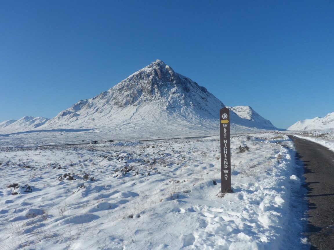
Section seven is short, 9 miles from Kingshouse to Kinlochleven, and it holds the route’s high point. From Kingshouse, below the great pyramid of Buachaille Etive Mor at the entrance to Glencoe, the path climbs the Devil’s Staircase, a zigzag ascent built in the era of the old military roads, to about 550 m (1,800 ft). The name promises worse than the path delivers: it is a steady, well-made climb, steep in its lower zigzags and easing as it tops out, with the reward of a full view back over Rannoch Moor and forward to the Mamores. The longer half of the day is the descent, a broad track dropping steadily into Kinlochleven, which is harder on knees than the climb was on lungs. Poles earn their carry here. In snow, ice or a full gale the pass is a serious place, and the honest options are a rest day or the bus from Glencoe; the Way keeps for another attempt.
How does the walk finish in Fort William?
The last section repays an early start. The climb out of Kinlochleven is the steepest sustained pull of the final days, up through birchwoods to the open pass of the Lairigmor, where ruined shielings mark an older, harder use of the glen. The track then runs long and rough beneath the Mamores before turning into Glen Nevis, with Ben Nevis, Britain’s highest mountain, filling the view ahead. The route enters Fort William through the glen and finishes in Gordon Square at the bronze statue of a seated walker, the counterpart to Milngavie’s obelisk 96 miles south. Most walkers add a night in Fort William, and many add the mountain: a clear next day is the natural moment for Ben Nevis itself, on legs that will have opinions about it. Trains run from Fort William back to Glasgow along one of Britain’s great railway lines, closing the loop without a car shuffle.
Frequently Asked Questions
How fit do I need to be for the West Highland Way?
Fit enough to walk 12 to 15 miles on consecutive days, with one longer day if you choose the seven-day split. The climbs are modest by mountain standards, the Devil’s Staircase topping out near 550 m, but the Loch Lomond shore section is slow and rough underfoot. Build up with regular hill walks in the boots you will wear, and break those boots in months ahead, not weeks.
When is the best time to walk it?
Late spring and early autumn are the classic windows: May and June bring long days and, usually, the driest ground, while September keeps the light and loses some of the crowds. Midges are a genuine factor in still, damp summer weather along the loch and in the glens, so summer walkers should pack repellent and a head net and treat both as essentials, not jokes. Winter walking is for experienced, equipped hillwalkers only.
Can I camp instead of booking beds?
Yes, with homework. Scotland’s access rights allow responsible wild camping along much of the route, but the Loch Lomond shore section sits inside a camping management zone where, in season, camping is restricted to permits and designated sites along the loch. Campsites and bunkhouses punctuate the rest of the route. Baggage operators will also deliver to many campsites, which makes a tent plus a transferred bag a workable middle way.
How much should I budget for baggage transfer?
Plan on roughly £65 to £75 per bag for the full route at current listings, with Sherpa Van at £75 per bag and a 20 kg maximum when checked for this guide. Part-route transfers are priced on request by most operators. It is the best-value line in the whole trip budget: it converts a backpacking route into a walking holiday.
Which direction should I walk?
South to north, Milngavie to Fort William, as almost everyone does. The terrain builds in the right order, gentle farmland to loch shore to moor and mountain pass, the prevailing weather is more often at your back, the baggage and accommodation systems are built around that flow, and the finish under Ben Nevis is the ending the route deserves.