 Omar Haddad
Chefchaouen has a second act, and it starts where the blue paint ends: about 30 kilometres, roughly 45 minutes by road, northeast of the medina, the village of Akchour sits inside Talassemtane National Park in the Rif Mountains, where one trailhead splits toward a chain of river pools and waterfalls on the Oued Farda and toward God Bridge, a natural rock arch above the gorge. Add the trailheads climbing straight out of town and the weavers quarter that most day trippers never enter, and Chefchaouen stops being a photo stop and becomes a hiking base. This guide plans that second act honestly, with the distances, the fork in the trail and the seasons that decide what you will actually see.
Quick Facts
- Where: Chefchaouen, in the Rif Mountains of northern Morocco, and Akchour village inside Talassemtane National Park
- Distance to Akchour: About 30 km from Chefchaouen, around 40 to 45 minutes by car or taxi
- The trail fork: Left for the waterfalls and pools, right for God Bridge, from the same Akchour trailhead
- Lower waterfalls: About 45 minutes each way, easy walking, with a natural swimming pool
- Great Waterfall: About 4 to 5 hours round trip, demanding, the tallest fall in the valley
- God Bridge: About 3 hours round trip, a natural arch roughly 25 metres above the gorge
- Entry: No official ticket for the Akchour trails; carry small cash for parking, guides and riverside cafes
Why does Chefchaouen reward a second day more than a second photo walk?
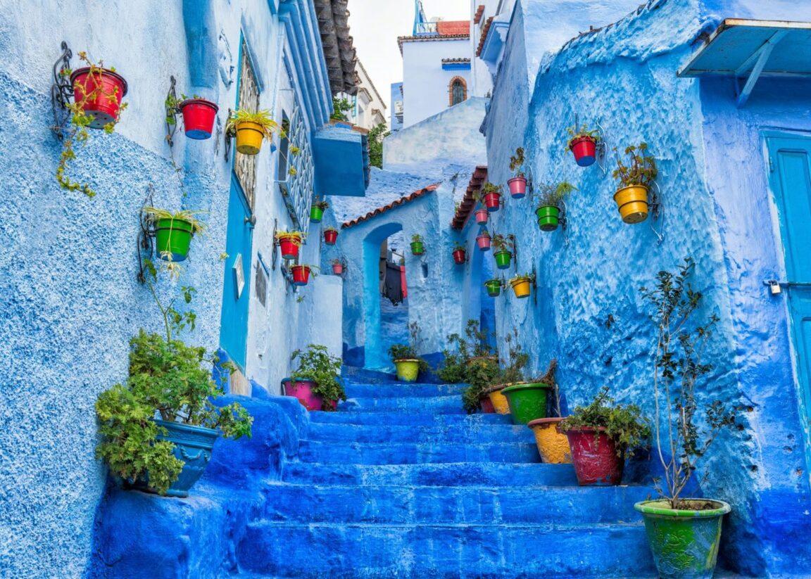
The medina is genuinely beautiful and genuinely small. Founded in 1471 as a kasbah against Portuguese expansion, washed in its famous blues, it can be walked end to end in a morning, and most visitors do exactly that and leave by lunch. What they miss is the geography the town sits in: Chefchaouen is wedged into the Rif, under twin peaks that give the town its name, at the edge of Talassemtane National Park, a protected area of some 580 square kilometres and one of the last homes of the Moroccan fir, a rare relict species related to the Spanish pinsapo. The mountains are not a backdrop. They are the destination that the blue lanes happen to be standing in front of.
A second day changes your relationship with the town, too. Morning in the medina before the day buses arrive, a hiking day in the park, and an evening in the quarters where people actually work, the weavers with their looms, the bakeries, the upper lanes near the Ras el Maa spring where local women wash laundry at the waterfall at the medina edge. That rhythm, town, mountain, town, is how Chefchaouen was lived long before it was photographed. Travellers continuing south can pair it with our Essaouira travel guide for the Atlantic counterpoint to the Rif.
How do you get to Akchour, and what happens at the trailhead?
Akchour village lies about 30 kilometres from Chefchaouen, around 40 to 45 minutes by road on a winding mountain route. Most visitors take a grand taxi, shared or private, agree the return arrangement before setting off, and start walking from the parking area by the river. There is no official entry ticket for the trails. Riverside cafes line the first stretch, serving tea and tagines to hikers, and local guides offer their services at the trailhead; for the lower falls you do not need one, and for the Great Waterfall in high water or low confidence, a guide earns his fee in route finding alone.
The decisive moment comes early: a fork where the river runs down the middle. The left hand trail follows the Oued Farda toward the waterfalls, crossing and recrossing on wooden footbridges and concrete slabs past a staircase of small cascades and pools. The right hand trail climbs toward God Bridge. Strong hikers do both in a long day; everyone else should choose one and do it properly, because the valley punishes the greedy itinerary with a rushed, footsore version of everything.
Which Akchour trail should you choose: lower pools, Great Waterfall or God Bridge?
The lower waterfalls are the democratic option: about 45 minutes each way on an easy, well marked path, ending at cascades with a natural pool where swimming is the whole point in summer. The vegetation closes in, moss on the rocks, oleander and dense green shade, and the water runs cold and clear. This is the right choice for families, hot afternoons and anyone whose knees vote no.
The Great Waterfall is the expedition: beyond the lower falls the trail climbs steadily for roughly another hour and a half, and the full round trip runs about 4 to 5 hours with steep sections. The reward is the valley main event, a fall dropping several dozen metres, commonly put between 60 and 80 metres, into a basin walled with green rock. It demands fitness, an early start and respect in wet weather, when the river crossings that were charming in August become the crux of the day.
God Bridge, Pont de Dieu, is the geologist walk: about 3 hours round trip to a natural limestone arch standing roughly 25 metres above the gorge, carved by the river it now spans. The trail is moderate, rockier than the waterfall path, and the viewpoint payoff is different in kind, architecture made by water rather than water itself. If you have one hiking day and dry weather, the Great Waterfall is the classic; if you have swum in a hundred pools and want the strange thing, take the bridge.
What are the trailheads above Chefchaouen itself?
You do not need a taxi to hike from Chefchaouen. The Spanish Mosque on the hill east of town is the gentle start, a short climb from the Ras el Maa waterfall at the medina edge to a whitewashed ruin with the definitive view back over the blue rooftops, best at sunset. Beyond it, paths climb into the Rif foothills toward the Talassemtane trail network, and multi day walkers use Chefchaouen as the gateway to the park interior, including routes toward the fir forests and the park high villages. These upper trails are less marked than Akchour and are where a local guide stops being optional colour and becomes the sensible plan; arrange one through your riad, agree the route, distance and price before you leave town, and carry water as if the fountains on the map do not exist, because seasonally they may not.
For pacing across a Morocco trip, think of the Rif as the green counterweight to the south. Our 2 days in Marrakech itinerary runs hot, red and urban; Chefchaouen and Akchour run cool, green and river fed, and a route that holds both understands the country better than either alone.
Where is the weavers quarter, and why do most visitors skip it?
They skip it because it is not blue enough for the photograph and not signed for the visitor, which is exactly its value. Chefchaouen traditional economy runs on wool: blankets, throws and garments woven on wooden looms in small workshops in the medina upper quarters, dyed in the mountain palette of undyed wool, madder reds and saffron yellows that break the blue spell completely. Walk uphill, away from the square of Outa el Hammam and its cafe terraces, listen for the shuttle rhythm of the looms, and you will find workshops where watching costs nothing and buying is a conversation rather than a transaction. A woven blanket bought from the man who made it, at a fair haggled price, is the one Chefchaouen souvenir that improves with age instead of fading in a drawer.
The same uphill logic finds the rest of working Chefchaouen: the communal bakeries where households send dough, the Ras el Maa washing stones, the lanes where the paint is for the residents and not the camera. Go respectfully, ask before photographing people, and remember that a medina is a neighbourhood first and a backdrop second.
When should you go, and what should you carry?
Spring and autumn are the valley best seasons: the river runs full, the falls are at strength and the trails are warm rather than punishing. Summer is swimming season at the lower pools and the busiest time at Akchour, so start early. Winter and any period after heavy rain change the calculation entirely; the gorge trails involve river crossings, and the honest rule is to avoid the valley in flood conditions and ask locally on the day. Carry shoes that can get wet and grip, swimwear under hiking clothes in summer, cash in small notes, sun protection for the exposed climbs, and more water than the cafe map suggests. Leave the falls area as you found it; Talassemtane is a protected park and a biosphere reserve landscape, and its pools stay clear only as long as its visitors behave as if they will return.
Frequently Asked Questions
How far is Akchour from Chefchaouen, and how do I get there?
About 30 kilometres, roughly 40 to 45 minutes by road. Take a shared or private grand taxi from Chefchaouen, agree the return plan with the driver before you set off, and start walking from the parking area at Akchour village.
How long are the Akchour hikes?
About 45 minutes each way to the lower waterfalls and their swimming pool, about 4 to 5 hours round trip to the Great Waterfall, and about 3 hours round trip to God Bridge. The trails share one trailhead and split at a fork by the river.
Can you swim at Akchour?
Yes, in the natural pools along the waterfall trail, with the main swimming pool at the lower waterfalls. The water is cold mountain river water; take care on wet rock and avoid the gorge after heavy rain.
Is there an entrance fee for Talassemtane National Park at Akchour?
There is no official ticket for the Akchour trails. Carry small cash for parking, an optional local guide, and the riverside cafes along the first stretch of the path.
What is God Bridge at Akchour?
A natural limestone arch, Pont de Dieu, spanning the gorge roughly 25 metres above the Oued Farda, reached by the right hand trail from the Akchour trailhead in about 3 hours round trip.
Do I need a guide for hiking near Chefchaouen?
Not for the lower Akchour waterfalls, which are well marked. A local guide is recommended for the Great Waterfall in difficult conditions and for the less marked Talassemtane routes above town; agree route and price before leaving.