 Thandiwe Nkosi
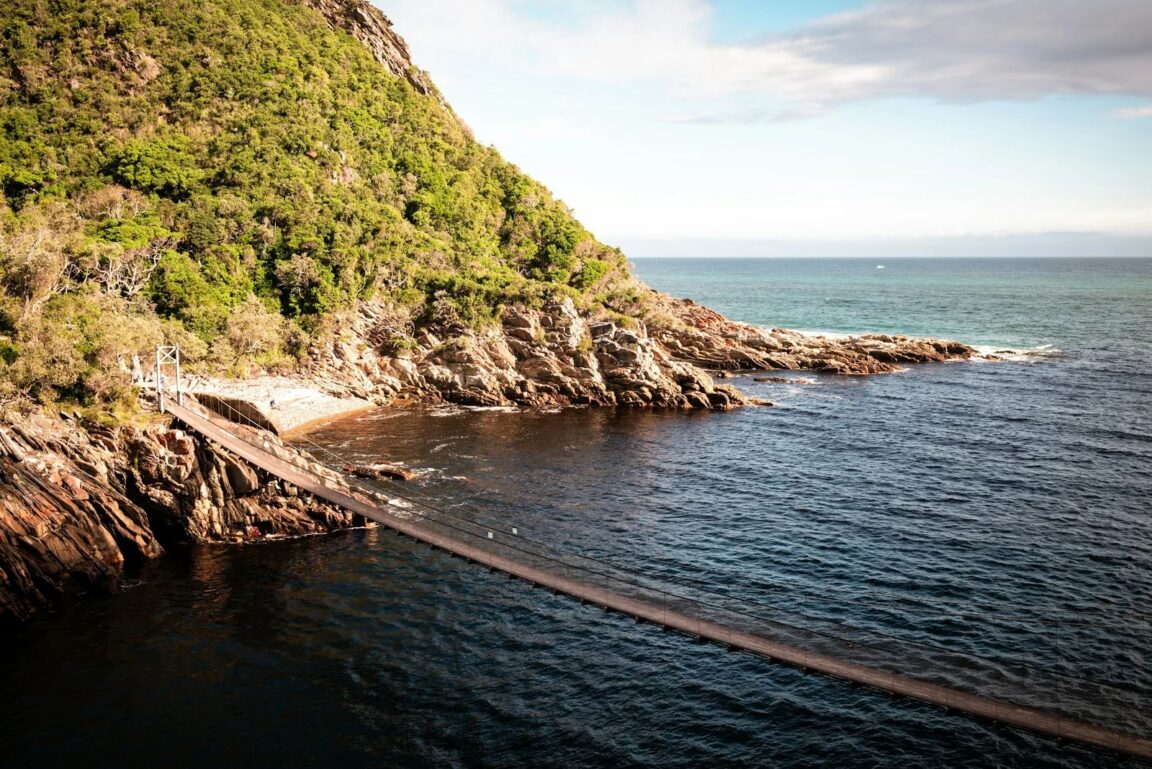
The Otter Trail is a five day, roughly 45 kilometre coastal hike from Storms River Mouth to Nature’s Valley in the Tsitsikamma section of the Garden Route National Park, and the single fact that shapes every plan is scarcity: only 12 hikers start each day, and places are routinely booked about a year ahead through South African National Parks, known as SANParks. Everything else follows from that. You book first, often for a date chosen by availability rather than preference, and then you train, pack and plan your tides around the date you secured. This guide explains the booking reality, the simple hut system, the four river crossings that give the trail its reputation, and the fitness the short daily distances quietly conceal.
Quick Facts
- Route: Storms River Mouth to Nature’s Valley (De Vasselot), Tsitsikamma, South Africa
- Distance and duration: About 45 km over 5 days and 4 nights, sources vary between 42.5 and 45 km by measurement method
- Group limit: A maximum of 12 hikers start per day
- Booking lead time: Commonly 12 months or more for popular months; bookings open on the SANParks rolling booking calendar
- Overnight stops: Ngubu, Scott, Oakhurst and Andre, each with two huts sleeping six
- Age limits: Hikers must be at least 12 and no older than 65 under SANParks trail rules, with the trail’s own medical and disclaimer paperwork required
- Hardest day: Day 4, about 13.8 km, ending around the Bloukrans River crossing, which must be timed to low tide
- Carry: Everything. There is no resupply, no porter service on the standard trail, and no shop after Storms River
Why does the Otter Trail book out a year ahead?
The arithmetic is unforgiving. Twelve starters a day, one direction only, no overlapping groups on the same hut night, and a trail that has been famous since it became South Africa’s first official multi day hiking trail. Demand from local hiking clubs alone could fill the calendar, and international walkers plan Garden Route trips around a secured Otter date rather than the other way round. SANParks releases bookings on its standard rolling periods, and the practical advice from every source, including SANParks itself, is the same: check availability the moment your window opens, take the date you can get, and treat cancellations, which do appear, especially in the cooler winter months, as a watched second chance rather than a strategy.
Two consequences deserve emphasis. First, a group that wants a specific month, particularly the summer holiday season and Easter, should be organising itself a full year out, with names, ages and payment ready, because a hesitation measured in days can cost a season. Second, flexibility is the solo or pair traveller’s superpower: one or two places inside an otherwise booked departure appear far more often than a block of eight, and the trail is walked in the company of whoever else booked that date, which most hikers end up counting as part of the experience.
The hut system, hut by hut in spirit
Each overnight stop has two wooden huts, each sleeping six on bunk beds with mattresses, giving the night’s twelve hikers a hut per six. Expect a shared toilet and a cold shower, rainwater tanks, an outside braai area with firewood supplied, benches, and a setting that does a great deal of the trail’s persuading: every stop sits close to the shore, and the sound of the Indian Ocean is the night’s constant. There is no electricity to rely on, no bedding beyond the mattress, and no food of any kind. Your sleeping bag, your stove, your meals and your head torch all arrive on your back.
The daily pattern settles quickly. Day 1 is deliberately gentle, about 4.8 km from the Storms River start to Ngubu Huts, with time to register, watch the trail briefing video, and still walk in daylight. Day 2 covers about 7.9 km to Scott Huts at the Geelhoutbos River mouth, crossing the Kleinbos River on the way. Day 3, about 7.7 km to Oakhurst Huts, is the first true river day, with the Elandsbos and Lottering crossings. Day 4 is the long one, about 13.8 km to Andre Huts, built around the Bloukrans. Day 5 walks out to Nature’s Valley and the De Vasselot finish, roughly 8 to 10.8 km depending on the measurement used, where the trail ends and onward transport back to Storms River or to your next Garden Route stop needs to have been arranged in advance.
The four river crossings, explained honestly
River crossings are the Otter’s signature hazard, and they are tidal, which means the clock, not your legs, sets the schedule. The Kleinbos on Day 2 is usually the gentlest, a wade with good swimming pools nearby in fair conditions. The Elandsbos on Day 3 is known for slippery rock underfoot. The Lottering, also on Day 3, should be crossed at low tide where possible, when it can be a straightforward wade rather than a swim. The Bloukrans on Day 4 is the serious one. It must be crossed within about an hour of low tide, which can mean starting Day 4 before dawn with head torches, and if the river is flooded, the sea is rough, or you arrive at the wrong state of the tide, the correct move is the signed escape route, marked E6 on the trail map, which climbs out before the descent to the river mouth. Using an escape route is not failure. Hikers who have needed one describe the climb out and the road walk as the price of a rule the trail states plainly: never cross a flooded river.
Preparation is simple and specific. Carry a dry bag or survival bag for your pack’s contents at crossings, keep boots or sturdy sandals you are willing to walk wet in, unclip your hip belt before entering the water so you can shed the pack if you fall, and check the tide table issued with your trail paperwork against every crossing day, not just Day 4. After heavy rain, every judgement gets more conservative, because these rivers rise fast off the Tsitsikamma mountains. For a very different multi day walk with booked lodges instead of huts, compare our explainer on the Salkantay Trek lodge route in Peru, and for a gentler coastal base in the same walking spirit, our guide to Nelson as a base for Abel Tasman.
How fit do you actually need to be?
Fit enough that the daily distances mislead you, and then fit some more. The longest day is under 14 km, which sounds modest until the profile is understood: the trail climbs from sea level to the cliff tops and drops back down, repeatedly, on rock, root and sand, for a total ascent commonly measured around 2,600 metres across the five days. Add a pack carrying five days of food, wet river crossings that slow the whole group, and a Day 4 that may start in the dark, and the honest grading most guides settle on, moderate to demanding, a six out of ten that feels harder in the rain, is fair. Train with loaded pack walks on consecutive days, practise descending on uneven ground, and break in the exact boots you will cross rivers in. Anyone with a medical condition, and every hiker under the trail’s paperwork rules, should treat the SANParks medical questionnaire and disclaimer process as part of preparation, not administration to rush at the trailhead.
What to pack, and what the trail provides
The trail provides huts, mattresses, firewood, water points shown on the official map, and the route marking of yellow footprint signs. It does not provide food, bedding, cooking equipment, or drinking water guarantees at every stream: the official guidance flags that water from certain rivers, including the Kleinbos, Elandsbos and Lottering, should not be drunk, so carry purification for the water points you do use and the capacity to carry water between them. Pack for four seasons inside five days, because Tsitsikamma weather turns quickly off the ocean: full waterproofs, a warm layer for hut evenings, sun protection for exposed cliff sections, insect repellent for ticks, a first aid kit, an emergency blanket, a rope for crossings and pack hauling, and food that survives being carried, soaked in sea air, and cooked on a small stove. Register at Storms River reception by the stated check in time on Day 1, watch the briefing, collect your map and tide information, and weigh your pack with the humility the first climb will otherwise teach you.
Frequently Asked Questions
How far in advance should I book the Otter Trail?
Plan on about a year. Only 12 hikers start daily and popular months sell out as soon as the SANParks booking period opens. Winter dates and single places from cancellations are the realistic exceptions, so flexible hikers should keep checking availability rather than assuming the trail is full.
How long and how hard is the Otter Trail?
About 45 km over five days, with daily stages of roughly 4.8, 7.9, 7.7, 13.8 and 8 to 10.8 km. The distances are short but the climbing is constant, with around 2,600 metres of total ascent, river crossings, and a full pack to carry, so a solid base of hiking fitness is essential.
What are the huts on the Otter Trail like?
Simple and well sited. Each of the four stops, Ngubu, Scott, Oakhurst and Andre, has two huts sleeping six each on bunk beds with mattresses, plus a toilet, a cold shower, rainwater tanks and a braai area with firewood. You bring your own sleeping bag, stove and all food.
Which river crossing is the most dangerous?
The Bloukrans River on Day 4. It must be crossed within about an hour of low tide and can require a pre dawn start. If conditions are wrong, use the signed E6 escape route instead of crossing. The Lottering on Day 3 also demands low tide respect.
Is there an age limit for the Otter Trail?
Yes. SANParks trail rules set the range at 12 to 65 years, and hikers complete medical questionnaire and disclaimer paperwork as part of the booking and check in process. Confirm the current requirements when you book, as the rules are enforced at the trailhead.
Can I drink the river water on the trail?
Not from every river. Official trail guidance warns against drinking from the Kleinbos, Elandsbos and Lottering rivers. Use the marked water points, carry enough capacity between them, and purify water as a matter of routine.