 River Callahan
Base in Bayfield and run three distinct day trips, one per day: the mainland sea caves from Meyers Beach, a ferry day on Madeline Island, and a slow southern loop through Washburn and the orchard hills above town. Bayfield, a Lake Superior harbour town in northern Wisconsin, is the gateway to Apostle Islands National Lakeshore, a National Park Service unit of 21 islands plus a mainland strip, and the planning errors here are all about water and timing. The sea caves are a weather decision, the ferry takes no reservations, and the last return sailing sets the real end of an island day. This guide settles the distances, parking fees, crossing times and booking rules first, using the National Park Service and the Bayfield visitor bureau sources checked today, so each day trip can be chosen and sequenced before anything is paid for.
Quick Facts
- Base: Bayfield, Wisconsin, on the Bayfield Peninsula above Lake Superior, gateway town for Apostle Islands National Lakeshore.
- The park: Apostle Islands National Lakeshore covers 21 islands and a mainland section. There is no general entrance fee. You pay for parking, camping, docking and commercial tours.
- Meyers Beach: The mainland sea cave launch and Lakeshore Trail trailhead off Highway 13, about 18 miles west of Bayfield via Cornucopia direction roads and roughly 25 minutes by car. Parking costs $5 for a vehicle under 20 feet, per the National Park Service, with stairs down to the beach.
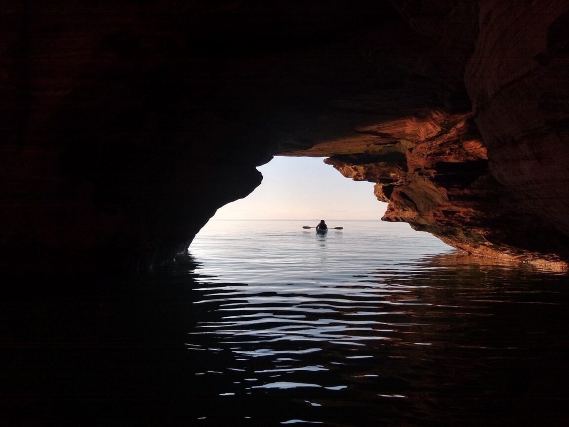
- Sea caves by kayak: The Meyers Beach sea caves begin about 1.5 miles from the launch and extend for another 3 miles along the mainland shore, per the NPS. Visit only in calm conditions.
- Madeline Island ferry: The crossing from Bayfield to La Pointe covers about 2.5 miles and takes about 25 minutes, per the Bayfield Chamber and Visitor Bureau. In summer the ferry leaves about every 30 minutes in the day. Reservations are not accepted, for passengers or vehicles.
- Washburn: About 13 miles south of Bayfield on Highway 13, the natural half day pairing with the orchard stops on County Highway J above Bayfield.
- Water warning: Lake Superior surface water rarely exceeds 60 degrees Fahrenheit even in late summer, per the NPS, and average May and June temperatures are in the 40s. Kayak plans are cold water plans.
How do you do the Meyers Beach sea caves as a day trip?
Two ways, and the choice should be made on the morning’s marine forecast, not at the car park. The paddle is the classic version: launch at Meyers Beach, where the NPS lists a $5 parking fee and stairs down to the beach, and cover the roughly 1.5 miles to where the mainland sea caves begin, with the cave section then running for about another 3 miles of shoreline. The full return paddle is a serious half day on the largest lake in the world by surface area, and the Park Service is blunt about the terms: sea kayaks of at least 16 feet, wetsuits or drysuits, spray skirts, life jackets worn, and no small open boats, canoes, sit on top kayaks or paddleboards at the caves. Kayakers have had fatal accidents here, waves bounce off the rock into confused water, and guided trips with authorised outfitters are the recommended route for beginners. Book guides ahead in summer, because the same calm mornings that make the caves safe also sell out.
The second way needs no boat at all. The Lakeshore Trail runs above the caves from the same Meyers Beach trailhead, reaching the first major cave viewpoints at the Crevasse, about 1.8 miles each way, for a 3.6 mile round trip on a trail the Park Service rates as demanding in places, with steep pitches and stream crossings. You see the caves from above rather than from inside them, which is a different photograph but the same geology, and the trail works on days when the lake is too rough to paddle. Start early in summer: the small lot fills, and the $5 parking fee applies either way. If the wind is up, swap the days around and take the ferry day instead, which is exactly why these trips should be planned as a flexible set rather than fixed to dates.
How does a Madeline Island ferry day actually run?
Madeline Island is the largest of the Apostle Islands and the only one with a year round town, La Pointe, and it works as a day trip because the logistics are simple and unforgiving in equal measure. The Madeline Island Ferry Line crossing takes about 25 minutes for the roughly 2.5 mile run, runs about every 30 minutes through the summer day, and takes no reservations at all, per the Bayfield Chamber and Visitor Bureau: you buy tickets at the Bayfield dock at the foot of Washington Avenue and join the line, arriving about 20 minutes before the sailing you want, earlier with a car on peak weekends. That single fact shapes the day. Walk on passengers and cyclists travel lightest and cheapest, and the island rewards them, since La Pointe’s shops, museum and cafes sit at the dock and Big Bay State Park, with its beach, boardwalk and cliff trails, lies about 5 miles across the island by bike or car.
The return timing is the discipline. Because there is no booking, the last comfortable return is never the last scheduled sailing, which can fill with vehicles on Sunday afternoons and fall colour weekends. Set a hard island departure one or two sailings before the final boat, and treat any extra time in Bayfield as a bonus rather than a failure. In winter the system changes character entirely: the ferry runs until ice stops it, after which an ice road or windsled may serve the island when conditions allow, and the Park Service and ferry line post the current status. Summer visitors should also know the island day pairs well with an evening back in Bayfield, since the crossing is short enough that dinner on the mainland is realistic.
What is the Washburn and orchard loop?
The third day trip trades water for farmland and is the right answer for a rough lake day or a slow final morning. Drive south on Highway 13 about 13 miles to Washburn, a working harbour town with a walkable main street, a marina on Chequamegon Bay and an easier, less crowded rhythm than Bayfield in peak season. Give it a morning: coffee, the waterfront, and the small town shops, with the option of continuing a few miles to Ashland and its Lake Superior mural trail if the group wants a longer day. Then angle back north and climb into the hills above Bayfield for the orchard stops along County Highway J, the self guided Fruit Loop of family farms that the Bayfield County listings document in detail: Erickson’s Orchard and Country Store on Betzold Road, Hauser’s Superior View Farm and the Bayfield Apple Company on County Highway J among them, selling apples, berries in season, cider, jams and baked goods from farm stores with lake views.
Orchard timing is seasonal in a way first time visitors miss. Berry picking runs through summer, with strawberries, raspberries and blueberries in sequence, while the apple harvest and the town’s famous Apple Festival belong to early fall, peaking around late September into October. A July orchard stop is a berry and cider stop, not an apple stop, and it is better for knowing it. Hours vary by farm and by day, and county listings show many stores keeping roughly 9 to 5 hours in season, so confirm the specific farm before driving up the hill. The loop is short, scenic and forgiving, which makes it the ideal final day trip before the drive home. For another small town base that rewards this same slow structure, see our Galena first timer guide, and for a desert small town day trip pattern, our Bisbee in winter guide.
Which day trip should you choose first?
Let the weather rank them. On the calmest morning of the stay, take the sea caves, by guided kayak if the group has the skills and kit the NPS requires, or on the Lakeshore Trail if it does not. On the clearest full day, take Madeline Island, with an early sailing out and a conservative sailing back. Save Washburn and the orchards for the windy day, the arrival afternoon or the departure morning, since neither depends on the lake at all. Boat tour passengers have a fourth option in the Apostle Islands Cruises Grand Tour from the Bayfield dock, a narrated loop of about 55 miles past island lighthouses and the Devils Island sea caves, which shows the archipelago to travellers who should not be paddling it. Whichever order you run, book guided kayaking and cruises ahead in summer, keep ferry plans reservation free and flexible, and check the NPS alerts and marine forecast each morning before committing the day.
Frequently Asked Questions
Is there an entrance fee for Apostle Islands National Lakeshore?
No general entrance fee applies. The costs are specific: $5 parking at Meyers Beach for a vehicle under 20 feet per the National Park Service, free parking at Little Sand Bay, plus camping, docking and commercial tour charges where they apply.
Can you reserve the Madeline Island ferry?
No. The Bayfield Chamber and Visitor Bureau states that reservations are not accepted beforehand for passengers or vehicles. Buy tickets at the Bayfield dock, arrive about 20 minutes before your sailing, and earlier with a vehicle on peak days.
How long is the ferry ride to Madeline Island?
About 25 minutes for the roughly 2.5 mile crossing between Bayfield and La Pointe, with departures about every 30 minutes through the summer day.
Can beginners kayak to the sea caves?
Only with support. The Park Service recommends guided trips for beginners, requires proper sea kayaks and cold water gear, and warns against small open boats and paddleboards at the caves. The caves begin about 1.5 miles from the Meyers Beach launch, and Lake Superior water rarely exceeds 60 degrees Fahrenheit in summer.
How far is Washburn from Bayfield?
About 13 miles south on Highway 13, an easy half day that pairs naturally with the orchard farm stores on County Highway J in the hills above Bayfield on the drive back.
Featured image: A kayaker silhouetted at the mouth of the Meyers Beach sea caves, Apostle Islands National Lakeshore. Photo by I. Campbell, National Park Service, via nps.gov.