 Camille Baptiste
Dubai’s Blue Line is building, but no one can ride it yet, and that distinction should shape any trip planned around it. The Government of Dubai Media Office, reporting the launch of the line’s main tunnelling works on 3 May 2026, puts the project at 20 percent complete, with completion expected to reach 30 percent by the end of 2026 and the line set to open on 9 September 2029. When it does open, the Blue Line will be a 30 kilometre route with 14 stations that links the existing Red Line at Centrepoint and the Green Line at Creek, then runs in two branches that meet at International City 1: a 21 kilometre arm through Dubai Festival City, Dubai Creek Harbour and Ras Al Khor, onward through International City 2 and 3 and Dubai Silicon Oasis to Dubai Academic City, and a 9 kilometre arm through Mirdif and Al Warqa. Until 2029, visitors use the Red and Green lines exactly as they do today, and any hotel or apartment marketed on a future Blue Line station is selling a promise, not a commute.
Quick Facts
- Status: Under construction, not open. The Dubai Media Office reported 20 percent completion on 3 May 2026, with 30 percent targeted by the end of 2026.
- Opening target: 9 September 2029, twenty years after Dubai Metro first opened on 9 September 2009.
- Route: 30 kilometres in total, 15.5 kilometres underground and 14.5 kilometres above ground.
- Stations: 14, including three interchange stations, seven elevated stations and four underground stations.
- Interchanges: Creek on the Green Line, Centrepoint on the Red Line, and International City 1, where the two Blue Line branches meet.
- Investment: More than 20.5 billion dirhams, per the Dubai Media Office.
- Contractors: A consortium of MAPA, LIMAK and CRRC Hong Kong, awarded the project in December 2024.
- What to use today: The existing Red and Green Metro lines, which remain the whole of the Metro network until 2029.
Is the Dubai Metro Blue Line open?
No. The Blue Line is a construction project, and the timeline is unusually well documented because Dubai has staged its milestones publicly. The route was approved in November 2023, the construction contract was awarded in December 2024, and the foundation stone was laid in June 2025. On 3 May 2026 the Ruler of Dubai formally launched the primary tunnelling works at the International City 1 station site, starting the tunnel boring machine the Roads and Transport Authority has named Al Wugeisha. At that ceremony the project stood at 20 percent completion, with more than 10,000 workers deployed and more than 500 engineers and experts overseeing delivery, and the consortium had completed more than 13 million work hours without a lost time injury. The published schedule expects completion to reach 30 percent by the end of 2026 and sets the opening for 9 September 2029. Treat that date as the official target it is, not as a booking guarantee three years out.
Where will the Blue Line actually run?
The line is best understood as a Y shape lying on its side. The longer arm starts at Creek interchange station on the Green Line in Al Jaddaf and runs for 21 kilometres with ten stations. It passes Dubai Festival City, Dubai Creek Harbour and the Ras Al Khor industrial area before reaching International City 1, then continues through International City 2 and 3 and Dubai Silicon Oasis to its terminus at Dubai Academic City. The shorter arm starts at Centrepoint interchange station on the Red Line in Al Rashidiya and runs for 9 kilometres with four stations, passing through Mirdif and Al Warqa before joining the other arm at International City 1. A depot and maintenance facility for the line’s trains is being built at Al Ruwayyah 3.
The geography is the story. The Red and Green lines serve the older city along the Creek, the airport corridor and the Sheikh Zayed Road spine. The Blue Line instead serves the districts that grew up east of that spine: Mirdif and Al Warqa, long established residential areas with no Metro station today; International City, one of the city’s densest housing districts; Dubai Silicon Oasis, the technology and knowledge hub named in the Dubai 2040 Urban Master Plan; and Academic City, the university district. The Media Office states the line will serve nine key districts with a projected population of around one million people by 2040, and that it is expected to cut traffic congestion by 20 percent along the corridors it serves and to put Dubai International Airport within a 20 minute direct journey of those districts.
Which stations will matter most to visitors?
Three stations carry the network logic. Creek, in Al Jaddaf, is where Blue Line passengers will change to the Green Line for the old city, the Creek souks and the airport side stations of the Green Line. Centrepoint, in Al Rashidiya, is where they will change to the Red Line for Dubai International Airport’s Terminal 1 and 3 stations, Downtown Dubai and the Marina. International City 1 is the junction of the two Blue Line branches and, at more than 44,000 square metres, is being built as the largest underground interchange station in the Metro network, with an estimated capacity of around 350,000 riders a day, according to the Media Office briefing.
One station carries the spectacle. The Emaar Properties Station at Dubai Creek Harbour, designed by Skidmore, Owings and Merrill, will rise 74 metres, which the Media Office describes as making it the world’s tallest metro station. It covers about 11,000 square metres, is designed for up to 160,000 passengers a day, and is expected to pass 70,000 daily users by 2040, serving a Creek Harbour population estimated at 40,000 plus visitors. The line also includes the first Metro bridge across Dubai Creek, a 1.3 kilometre crossing whose piers are already under construction. Station interiors across the line follow four nature themes, air, water, earth and fire, divided among the stations, with the Emaar Properties Station treated separately as a gateway design built around open space and light.
How is the tunnelling being done?
From International City 1, tunnelling proceeds in three directions at once: one machine heading towards Mirdif, a second towards the Auto Market area, and a third towards Al Warsan, which is International City 2. The first tunnel boring machine, Al Wugeisha, is 163 metres long, weighs more than 2,000 tonnes and works around the clock, advancing on average 13 to 17 metres a day, per the Media Office. The project is also the first rail project in Dubai to include its own ready mix concrete batching plants and precast concrete sites, at Al Ruwayyah 3 and International City, producing viaduct segments and tunnel rings on site to control quality and keep supply in step with the dig. For travellers, the visible signs of all this over the next three years will be station construction sites and road diversions in Mirdif, Al Warqa, International City and around Dubai Creek Harbour, rather than anything they can ride.
What should a visitor do with this information now?
Plan Dubai trips in 2026, 2027 and 2028 entirely on the existing network. The Red Line covers the airport, Downtown, the Mall of the Emirates corridor and the Marina; the Green Line covers the Creek, Deira and Al Jaddaf, where our guide to Burj Al Arab, Dubai and our assessment of Atlantis The Royal, Dubai both sit on today’s map, not the 2029 one. If a property advertises a Blue Line station as a selling point, read it as a statement about the neighbourhood’s direction, and check the walking distance to a Red or Green station for the trip you are actually taking. And if your travel dates fall in late 2029, recheck the opening with the Roads and Transport Authority before building an itinerary around the new line, because a target date announced in 2026 is a plan, and plans on projects of this scale are confirmed, not assumed, as the year arrives.
Frequently asked questions
When does the Dubai Metro Blue Line open?
The official target is 9 September 2029, chosen to fall twenty years after Dubai Metro opened on 9 September 2009. The Dubai Media Office restated that date on 3 May 2026, when the project stood at 20 percent complete.
How many stations will the Blue Line have?
Fourteen: three interchange stations, seven elevated stations and four underground stations, across a 30 kilometre route split between 15.5 kilometres underground and 14.5 kilometres above ground.
Which existing lines will the Blue Line connect to?
Both of them. It meets the Green Line at Creek station in Al Jaddaf and the Red Line at Centrepoint station in Al Rashidiya, and its own two branches meet each other at International City 1.
Will the Blue Line serve Mirdif and Academic City?
Yes, those are two of its headline purposes. Mirdif is on the 9 kilometre Centrepoint branch, and Dubai Academic City is the terminus of the 21 kilometre Creek branch, which also serves Dubai Festival City, Dubai Creek Harbour, Ras Al Khor, International City and Dubai Silicon Oasis.
How much does the Blue Line cost?
The Dubai Media Office describes an investment of more than 20.5 billion dirhams. The construction contract was awarded in December 2024 to a consortium of MAPA, LIMAK and CRRC Hong Kong.
Can visitors use any part of the Blue Line before 2029?
No. It is a single integrated project with one opening date. Until then the Red and Green lines are the entire Metro network, and Blue Line station sites are construction areas, not transport facilities.
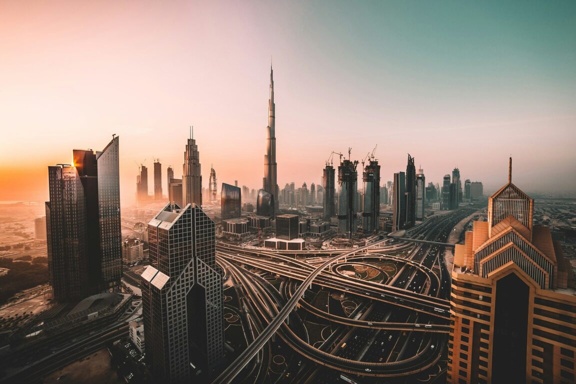
Photo: The Dubai skyline and the Sheikh Zayed Road corridor, with the existing Metro viaduct in the foreground, by an Unsplash contributor (photo 1512453979798-5ea266f8880c), via Unsplash, Unsplash License. The Blue Line itself is under construction east of this corridor and has no finished stations to photograph; the image shows the city and the existing Metro network the new line will join in 2029.