 Lucas Meyer
You get to El Morro National Monument by car, and only by car, on New Mexico Highway 53, and once you arrive everything starts and ends at one small visitor center. The monument is free, its nine site campground is free and first come first served, and its two trails run on strict last entry times: 2:30 pm for the 2 mile Headland Trail to Atsinna Pueblo and 4:00 pm for the 0.75 mile Inscription Rock Trail to the pool. Grants, 43 miles northeast, is the practical full service base. Plan the drive, the trail order and the season around those facts and El Morro is an easy half day. Miss the winter schedule, when the monument closes on Tuesdays and Wednesdays, and you will find a locked gate at the end of a long desert road.
Quick Facts
- Location: Mile marker 44.6 on NM Highway 53, near Ramah, New Mexico
- Entry cost: Free, including the nine site campground, per the National Park Service
- Winter hours: Thursday to Monday, 9:00 am to 5:00 pm, closed Tuesdays and Wednesdays, October 18, 2026 to May 27, 2027
- Summer hours: Daily, 9:00 am to 5:00 pm
- Inscription Rock Trail: 0.75 mile loop, about 45 minutes, last start 4:00 pm
- Headland Trail: 2 mile loop including Atsinna Pueblo, about 2 hours, last start 2:30 pm
- Nearest full service base: Grants, New Mexico, 43 miles northeast on NM 53 and Interstate 40
- Official source: National Park Service, nps.gov/elmo
How do you drive to El Morro from Grants and Interstate 40?
From the east, the standard approach is Interstate 40 west to Grants, exit 81, then south on Highway 53 for 42 miles to the monument entrance. From the west, take Interstate 40 east to Gallup, exit 20, then south on Highway 602 for about 31 miles and east on Highway 53 for 25 more miles. Both routes are paved, scenic and slow in the best way: Highway 53 threads past El Malpais National Monument lava fields, ponderosa forest and the Zuni Mountains, and services thin out quickly once you leave the interstate.
That thinning out shapes the whole trip. Fuel in Grants or Gallup. Download offline maps, because cell coverage fades along Highway 53. Carry water and snacks in the car, since the monument has a visitor center and campground but no store or cafe. The drive from Grants takes about an hour in good conditions, and winter mornings can add ice on shaded stretches near the Continental Divide elevations along the route.
Is there any public transport or shuttle to El Morro?
No. There is no bus, shuttle or tour transport that makes El Morro a practical car free trip, which is why this monument rewards drivers and quietly defeats everyone else. The closest intercity transport hubs are the Interstate 40 corridor towns. If you are traveling without a car, Grants is as far as conventional transport gets you, and the remaining 42 miles have no scheduled service. Renting a car in Grants, Gallup or Albuquerque is the realistic answer, and it doubles as your transport for the wider loop that most visitors build here.
That loop matters when you weigh El Morro against nearby alternatives. El Malpais National Monument sits between Grants and El Morro on the same Highway 53 corridor, with lava tubes and the La Ventana arch, and it works as a same day pairing rather than a rival. Travelers choosing one stop on a tight Interstate 40 schedule should pick El Morro for history, the inscription pool and the pueblo ruins, and El Malpais for geology and longer backcountry hiking. Travelers with a full day should do both, starting with the Headland Trail deadline at El Morro in the morning. Our explainer on which US parks still require reservations in 2026 is worth a read before a multi park Southwest loop, because the rules differ sharply from site to site.
How do you move around once you arrive at El Morro?
On foot, from a single trailhead. All trails begin and end at the visitor center, and the trails are only accessible while the visitor center is open. Start inside: rangers flag the day conditions, including the current partial closures the park lists on its alerts page, where a section of the Inscription Loop between markers 14 and 15 has been closed for rockfall and the south portion of the Headland Trail has been closed for restoration work. A two minute conversation at the desk can change which loop order makes sense that day.
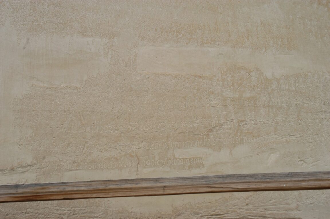
The Inscription Rock Trail is the core experience. The 0.75 mile loop leads to the shaded pool at the base of the bluff and past hundreds of Spanish and early American inscriptions and older petroglyphs, including the 1605 inscription of Don Juan de Onate. Allow about 45 minutes, and note the hard rule: you must start no later than 4:00 pm. The first section, to marker 16, is wheelchair accessible, making this one of the more inclusive historic trails in the region.
The Headland Trail contains the Inscription Loop and then climbs about 250 feet to the top of the bluff and the partially excavated Ancestral Puebloan dwelling of Atsinna, occupied in the late 1200s and early 1300s. The full loop is 2 miles and takes about 2 hours. You must begin by 2:30 pm and be back at the visitor center before the 5:00 pm close, and portions of the trail can close from November through April in winter weather. In practice the order writes itself: Headland first if you arrive before early afternoon, Inscription Loop only if you arrive later.
Where do you sleep: the free campground or Grants?
The monument campground is the characterful option: nine sites, free, open year round, first come first served with self registration, with vault toilets and no reservations. The National Park Service notes it occasionally fills on weekends from May through September, and campers must stay within 150 feet of the campground road to protect the surrounding resources. In the current winter season it is rarely full, but water and comfort are basic and nights at this elevation are cold.
Grants is the comfort option and the better winter base. At 43 miles northeast it has the motels, restaurants, groceries and fuel that the Highway 53 corridor lacks, plus its own Interstate 40 access for the next day drive. Gallup, about 55 miles northwest, is the alternative base if your route runs west. The honest trade off: camping puts you at the trailhead for first light on the bluff, while Grants buys you a hot dinner, a warm room and an easy resupply, at the cost of an hour drive each way. Many visitors split it, one night camped at El Morro and the rest of the loop based in Grants.
When is the best time of day and year to visit El Morro?
Morning wins in every season. The inscriptions read best in angled light, the Headland climb is coolest before midday, and an early start protects you against the 2:30 pm trail deadline if the drive runs long. Season matters more than most visitors expect. Winter hours, in effect now through May 27, 2027, close the monument on Tuesdays and Wednesdays, and snow or ice can close parts of the Headland Trail. Summer restores daily opening but adds afternoon thunderstorms over the bluff, another argument for the morning plan. Spring and autumn weekdays are the sweet spot: open days are frequent, the campground is quiet, and the pool sits still and reflective under the inscriptions.
Frequently Asked Questions
Is El Morro National Monument free to enter?
Yes. Entry is free and the nine site campground is also free. No pass or reservation is required for either.
What days is El Morro closed in winter?
Under winter hours, October 18, 2026 to May 27, 2027, the monument is open Thursday to Monday, 9:00 am to 5:00 pm, and closed on Tuesdays and Wednesdays. Trails are only open while the visitor center is open.
How long do the two trails at El Morro take?
The Inscription Rock Trail is 0.75 mile and takes about 45 minutes, with a last start of 4:00 pm. The Headland Trail is 2 miles, takes about 2 hours including Atsinna Pueblo, and must be started by 2:30 pm.
How far is El Morro from Grants, New Mexico?
Grants is 43 miles northeast, about an hour by car via Highway 53 north to Interstate 40. It is the nearest town with full lodging, food and fuel.
Can I visit El Morro without a car?
Not practically. No public transport serves the monument. You need your own vehicle or a rental from Grants, Gallup or Albuquerque.
What is Atsinna Pueblo?
Atsinna is a large Ancestral Puebloan dwelling on top of the El Morro bluff, reached by the Headland Trail. Its ruins, excavated in part, overlook the valley and the pool that drew travelers to this watering place for centuries.
Last updated and facts checked: November 16, 2026, against National Park Service pages for El Morro National Monument, including its current alerts and winter hours. Travelers building a longer walking trip can compare the booking discipline here with our guide to New Zealand Great Walks bookings, where popular trails work on the opposite, reserve ahead model.