 Omar Haddad
You do not need to walk all 223 kilometres of the Larapinta Trail to understand why it is ranked among the world’s great walks. The trail is built in 12 official sections through Tjoritja / West MacDonnell National Park, each section ending at a trailhead, gorge or waterhole west of Alice Springs, so a well chosen two, three or five day slice, walked in the recommended April to September season, with campsites booked online in advance and water planned tank by tank, delivers the full Larapinta experience of quartzite ridges, desert waterholes and huge night skies, without the two week commitment of the end to end walk.
Quick Facts
- Full trail: 223 kilometres from the Alice Springs Telegraph Station to Mt Sonder, divided into 12 sections varying from 8.9 kilometres to 28.9 kilometres.
- Recommended season: April to September inclusive, per Northern Territory Parks guidance. Long walks in hot weather should not be attempted.
- Bookings: Walking and camping fees apply to overnight walks. Book and pay online before starting, and a Parks Pass applies for park entry, with Northern Territory residents exempt.
- Shortest section: Section 10, Ormiston Gorge to Finke River, 8.9 kilometres, about 4 hours, Grade 3 moderate.
- Classic short section: Section 3, Jay Creek to Standley Chasm, 13.6 kilometres, about 5.5 hours, Grade 4.
- Longest sections: Section 6, Hugh Gorge to Ellery Creek North, and Section 9, Serpentine Chalet Dam to Ormiston Gorge, both 28.9 kilometres and requiring an overnight camp.
- Water rule: Carry all water between tanks, treat tank water, and never rely on natural waterholes. Section 9 has no reliable surface water at all.
How the Larapinta is structured, and why sections work
The Larapinta Trail follows the spine of the West MacDonnell Ranges through Tjoritja / West MacDonnell National Park, which stretches for 161 kilometres west of Alice Springs. The Northern Territory Government’s official section guide at nt.gov.au, Sections of the Larapinta Trail, lists all 12 sections with distances, recommended times and difficulty grades. Every section is graded, from Grade 3 moderate to Grade 5 difficult, and the grading is honest desert grading. A Grade 4 section is moderate to difficult for a walker of average fitness carrying an overnight pack, over rocky, uneven ground, with steep ascents and almost no shade.
The section structure is what makes partial walks legitimate rather than compromised. Trailheads sit at the places travellers already visit: Simpsons Gap, Standley Chasm, Ellery Creek Big Hole, Serpentine Gorge, Ormiston Gorge, Glen Helen and Redbank Gorge. Sealed roads reach many of them from Alice Springs, so a walker can be dropped at one trailhead, walk a section or a linked group of sections, and be collected at another, sleeping at designated campsites in between. The official Tourism NT overview at northernterritory.com on Tjoritja / West MacDonnell National Park confirms the park framework: the larger permanent waterholes include Ellery Creek Big Hole, Ormiston Gorge, Redbank Gorge and Glen Helen Gorge, camping fees apply, and entry requires an NT Parks Visitor Pass for visitors, with pass prices listed on that page from AU$10 for a one day adult pass.
The eastern sections: the best first Larapinta
Section 1: Alice Springs Telegraph Station to Simpsons Gap, 24.7 kilometres
The trail begins at the Alice Springs Telegraph Station and heads west for 24.7 kilometres, with a recommended time of 9 hours, to Simpsons Gap. NT Parks rates it Grade 4 and notes that you will need to camp overnight, with views over Alice Springs and the surrounding lowlands and good birdwatching along the way. As a two day opener with a camp in between, it is the gentlest way to learn the trail’s rhythm: early starts, long light, rocky ground and a waterhole finish. Simpsons Gap itself, a prominent gap in the ranges close to town, rewards an unhurried arrival.
Section 2: Simpsons Gap to Jay Creek, 26.2 kilometres
Section 2 continues west for 26.2 kilometres, about 8.5 hours of walking, also Grade 4 and also requiring an overnight camp. The NT Parks guide describes walking through the home of some of the few brushtail possum colonies in Central Australia, in a landscape of rock outcrops more than 2 billion years old. Linked with Section 1, it makes a three to four day walk from the Telegraph Station to Jay Creek that covers the full eastern character of the ranges without any single extreme day.
Section 3: Jay Creek to Standley Chasm, 13.6 kilometres
If you have one day, this is the section most often recommended, and the official guide supports the choice. At 13.6 kilometres with a recommended time of 5.5 hours, Section 3 is Grade 4 and can be completed in one day by a walker with a good level of fitness. NT Parks calls it a challenging walk through some of the steepest and most rugged country in the ranges, with a low route available for walkers of average fitness. It finishes at Standley Chasm, known as Angkerle Atwatye, a narrow, dramatic chasm that is privately operated, with its own entry and camping arrangements, a kiosk and a sealed road back to Alice Springs. That combination of a serious ridge walk and a serviced, road connected finish makes Section 3 the natural first Larapinta day for fit walkers short on time.
The central sections: big ridges and the great waterholes
Section 4: Standley Chasm to Birthday Waterhole, 17.9 kilometres
Section 4 steps up a grade. At 17.9 kilometres and about 8.5 hours, it is Grade 5, difficult, and requires an overnight camp. The trail follows the high quartzite ridges of the Chewings Range to the summit of Brinkley Bluff, with views in all directions, then descends steeply through Stuarts Pass, an upper branch of the Hugh River, to Birthday Waterhole, a semi-permanent pool on the Hugh River. Walked from Standley Chasm after Section 3, it turns a day walk into a genuine three day traverse of the Chewings Range. It is also the point where water discipline stops being theoretical. There is no reliable water between Standley Chasm and Birthday Waterhole, so everything for the day and the night is carried from the start.
Sections 5 and 6: Birthday Waterhole to Ellery Creek, via Hugh Gorge
Section 5 runs 14.9 kilometres, about 9.5 hours, Grade 5, from Birthday Waterhole to Hugh Gorge, passing through Spencer Gorge, along the spine of Razorback Ridge and down the narrow Linear Valley to the Hugh River junction, with possible wading or swimming through pools in Hugh Gorge itself. Section 6 is the joint longest on the trail: 28.9 kilometres, about 10.5 hours, Grade 4, crossing the Alice Valley from Hugh Gorge in the Chewings Range to Ellery Creek Big Hole in the Heavitree Range, and NT Parks is clear that you will need to camp overnight on it. The reward at the end is Ellery Creek Big Hole, a large permanent waterhole and one of the great swimming finishes in the ranges. Together, Sections 4, 5 and 6 form a demanding five to six day central traverse that many experienced walkers rate as the finest continuous stretch of the whole trail.
Section 7: Ellery Creek North to Serpentine Gorge, 12.8 kilometres
After the long central sections, Section 7 is a comparative release: 12.8 kilometres, about 5 hours, Grade 4, with expansive views across the Alice Valley before the trail passes through the Heavitree Range on gently undulating terrain that allows a faster pace. It finishes at Serpentine Gorge, a narrow gap about 100 kilometres west of Alice Springs. As a single day walk between two road accessible trailheads, it suits walkers who want ridge views and a waterhole to gorge day without a Grade 5 commitment.
The western sections: Ormiston, the Finke and Mt Sonder
Section 8 runs 13 kilometres from Serpentine Gorge to Serpentine Chalet Dam, with views of the high quartzite ridgelines typical of the West MacDonnell Ranges, including Haasts Bluff and Mt Zeil, the highest point in the Northern Territory. Section 9, from Serpentine Chalet Dam to Ormiston Gorge, is the other 28.9 kilometre giant, Grade 5, taking about 12 hours across two days into the rugged heart of the range country, and NT Parks warns there is no reliable surface water along the way, so walkers carry a heavy pack with a two day supply of drinking water. It should only be chosen by experienced desert walkers.
Section 10 is the trail’s friendliest short option in the west: 8.9 kilometres, about 4 hours, Grade 3 moderate, from Ormiston Gorge to the Finke River, winding through limestone hills at the headwaters of one of the world’s oldest rivers, with some steep ascents despite the grade. Combined with time at Ormiston Gorge itself, with its permanent waterhole, towering red walls and kiosk, it makes an excellent single day introduction to the western ranges. Section 11 runs 26.3 kilometres from the Finke River to Redbank Gorge, across spinifex covered hills with Mt Sonder as the backdrop, and Section 12 is the finale: a 15 kilometre return climb from Redbank Gorge to the summit of Mt Sonder, about 6 hours, Grade 4, described by NT Parks as a very difficult climb worth the effort for views over ranges, plains, valleys and salt lakes. As a standalone day, the Mt Sonder return is a fitting way to taste the end of the trail without walking its full length.
Season, water and booking: the three disciplines
Season comes first. Every NT Parks Larapinta section information sheet states the same rule: the recommended walking season is April to September inclusive, dangerously hot weather can still occur in those months, long walks should not be attempted in hot weather, and winter nights can freeze, so warm clothing, a sleeping bag and shelter are required for camping. Outside that window, summer heat in the ranges is a genuine safety hazard, not a comfort issue. Plan section walks for the cooler months, start at first light, and build the day around finishing the exposed ridge work before the afternoon.
Water comes second. The Larapinta is a dry trail by design. NT Parks provides water tanks at trailheads and campsites, tank water should be treated before drinking, and natural waterholes, however beautiful, are never a planned water source. They can be low, stagnant or dry, and swimming holes such as Ellery Creek and Ormiston are destinations, not resupply points. Carry capacity for a full day at minimum, more on the long sections, and check current water and trail conditions with NT Parks before departing, because tank levels vary through the season.
Booking comes third, and it is not optional for overnight walks. NT Parks states on its section sheets that walking and camping fees apply to overnight walks on the Larapinta Trail and must be booked and paid online before you start your walk, through the NT parks booking system. Park entry fees also apply through the Parks Pass, with Northern Territory residents exempt. Standley Chasm is the exception to note in any itinerary: it is privately owned and operated, so its entry and camping fees are separate and paid to the operator. Day walkers who start and finish on the same day still need the correct park pass, current condition checks, and a walk plan left with a reliable contact. Mobile coverage is limited to absent across much of the trail, and official NT guidance for hiking in the park is to carry a satellite phone or personal locator beacon and tell someone where you are going. Travellers building a wider Australian itinerary around a Larapinta section walk can pair it with our guides to Hobart and Tasmania and a first time Sydney itinerary for the city ends of the trip.
Choosing your sections: three ready made plans
For a first taste in two days, walk Section 3 from Jay Creek to Standley Chasm as a full day, then spend the second day returning to the chasm at the hour when light strikes its walls, or add the short Section 10 walk at Ormiston Gorge as a contrasting second day reached by road. For a three to four day walk, link Sections 1 and 2 from the Telegraph Station to Jay Creek, camping along the way, and finish with a transfer to Standley Chasm. For the fullest short expedition, allow five to six days for Sections 4, 5 and 6 from Standley Chasm to Ellery Creek, with the fitness, water carrying capacity and desert experience those Grade 5 and long distance days demand. Each plan is a complete Larapinta experience. None of them requires pretending it was the whole trail.
Frequently asked questions
How long is the Larapinta Trail and how many sections does it have?
The trail runs 223 kilometres from the Alice Springs Telegraph Station to Mt Sonder and is divided into 12 sections. NT Parks lists section distances from 8.9 kilometres to 28.9 kilometres, each with a recommended time and difficulty grade.
When is the best time to walk the Larapinta Trail?
The recommended walking season is April to September inclusive, according to NT Parks. Hot weather can still occur in those months, long walks should not be attempted in heat, and winter nights can be freezing, so warm camping gear is essential.
Do I need to book to walk the Larapinta Trail?
Yes, for overnight walks. NT Parks states that walking and camping fees apply and must be booked and paid online before you start. A Parks Pass also applies for park entry, with Northern Territory residents exempt. Standley Chasm charges its own separate entry and camping fees.
Which is the best Larapinta section for a single day walk?
Section 3, Jay Creek to Standley Chasm, at 13.6 kilometres and about 5.5 hours, is the classic choice for fit walkers. Section 10, Ormiston Gorge to Finke River, at 8.9 kilometres and Grade 3, is the gentler alternative.
Can I rely on waterholes for drinking water on the Larapinta?
No. Plan around the NT Parks water tanks at trailheads and campsites, treat tank water before drinking, and carry all the water you need between tanks. Section 9 has no reliable surface water at all, and natural waterholes should never be a planned source.
Is Standley Chasm part of the national park booking system?
No. Standley Chasm is privately owned and operated. Its entry and camping fees apply separately from NT Parks fees, as noted on the NT Parks Larapinta section information sheets.
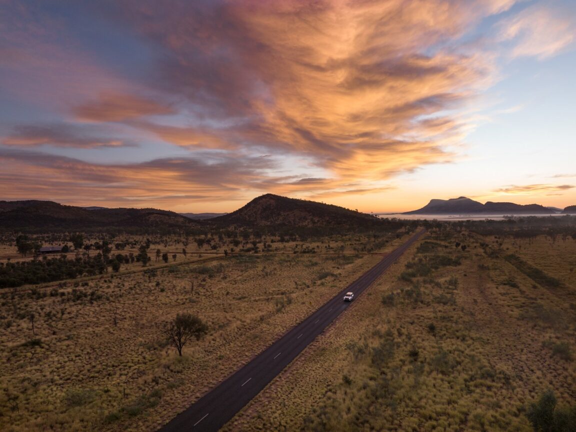
Photo credit: A car driving past the West MacDonnell Ranges at sunrise, Tjoritja / West MacDonnell National Park, Northern Territory. Photo via Tourism NT, northernterritory.com, the official Northern Territory tourism site.