 Lucas Meyer
Harpers Ferry is best read as a walking story in three chapters, in this order: stand at The Point where the Shenandoah meets the Potomac, walk the museum row on Shenandoah Street in Lower Town where the federal armory story is told building by building, then cross the river and climb Maryland Heights for the view that explains why armies fought over this gap in the Blue Ridge. The park pass costs $20 per vehicle and lasts three consecutive days, the visitor center and museums run 9 am to 5 pm, and a free shuttle links the main car park to Lower Town every 10 to 15 minutes, so the story, not the parking, sets your pace.
Quick Facts
- Where: Harpers Ferry National Historical Park, at the confluence of the Potomac and Shenandoah rivers in West Virginia, touching Maryland and Virginia.
- Entry: $20 per private vehicle, $15 per motorcycle, $10 per person on foot or bicycle, each valid for three consecutive days. The park annual pass is $35. Pay at the entrance station at 171 Shoreline Drive or online.
- Hours: Park open year round except Thanksgiving Day, December 25 and January 1. Visitor Center and Lower Town museums and exhibits open daily 9 am to 5 pm. Trails and car parks open from 30 minutes before sunrise to 30 minutes after sunset.
- Shuttle: Free park shuttle from the visitor center to Lower Town every 10 to 15 minutes. In standard time the last bus runs at 5:30 pm; in daylight saving time, at 7 pm. Pets are not permitted on the shuttle.
- The viewpoint: The Point, at the end of Shenandoah Street, where you look over two rivers and three states at once.
- The climb: Maryland Heights Trail, about 4.5 to 6.5 miles depending on the loop chosen, climbing to the overlook above the town and the Potomac water gap.
- The halfway home: The Appalachian Trail passes through Lower Town, and the Appalachian Trail Conservancy headquarters sits in Harpers Ferry, long treated by thru hikers as the psychological halfway point of the trail.
- Facts checked: 18 November 2026, against National Park Service Harpers Ferry hours, fees and place pages.
Why does the story start at The Point?
Every Harpers Ferry plot line, ferries, armory, John Brown, Civil War, floods, begins with geography. The town occupies a narrow point of land where the Shenandoah River joins the Potomac as the combined river cuts through the Blue Ridge in a water gap. From The Point, at the end of Shenandoah Street, you look at three states at once: West Virginia under your feet, Maryland across the Potomac at Maryland Heights, and Virginia across the Shenandoah at Loudoun Heights. The Park Service site for The Point notes the ground itself was business first: a ferry lot reservation kept back when the Wager family, heirs to town founder Robert Harper, sold land to the government for the armory in 1796, then a busy commercial strip once the Baltimore and Ohio Railroad viaduct crossed the Potomac in 1836.
That crossing is why the town kept being fought over. The railroad bridge here was destroyed and replaced nine times during the Civil War, and the iron spans designed by Wendell Bollman that followed carried trains until 1894 and road traffic well beyond. Stand at The Point first and the rest of the visit organises itself: the armory needed the rivers for water power and transport, the raiders and armies needed the gap, and the flood markers on Lower Town buildings make sense only once you have seen how little land sits between two rivers.
What does the armory museum row actually show?
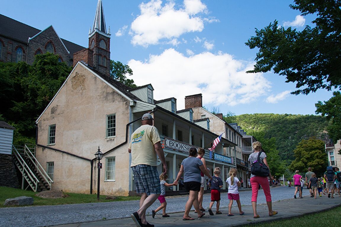
Lower Town is the preserved heart of the park, a few steep streets of stone and brick buildings along Shenandoah and High streets, with museums and exhibits open daily from 9 am to 5 pm. The United States Armory and Arsenal, authorised in the 1790s and producing muskets from the early 1800s, turned this ferry crossing into an industrial village, and the exhibits trace that arc: armory workers and their craft, the town’s role supplying the Lewis and Clark expedition, and the industry that made Harpers Ferry a prize worth seizing. The armory’s surviving fire engine house is the building the world knows as John Brown’s Fort.
On the night of 16 October 1859 the abolitionist John Brown and his small band seized the armory, intending to arm enslaved people and ignite a revolt. The raid ended on 18 October when US Marines under Robert E. Lee stormed the fire engine house where Brown had retreated. Brown was tried and hanged in nearby Charles Town, and the raid hardened both sides on the road to civil war. The fort building itself had an improbable afterlife, dismantled and moved several times, including a trip to the Chicago world’s fair in 1893, before returning to Harpers Ferry; it now stands close to, but not exactly on, its original site near The Point. Walking Shenandoah Street slowly, in building order, is the difference between a town that looks merely picturesque and one whose story you can retell.
Harpers Ferry also carries a second, later story that the museums tell well. Storer College, founded after the Civil War to educate formerly enslaved people, operated on Camp Hill above Lower Town, and in 1906 the Niagara Movement, a forerunner of the NAACP, held its first public meeting on American soil here, with W. E. B. Du Bois among those who walked barefoot to John Brown’s Fort at dawn. The Lockwood House on Camp Hill, a former armory paymaster’s home that later served Storer College, anchors that chapter.
Why climb Maryland Heights?
Because it is the illustration the whole story has been promising. From Lower Town, cross the Potomac on the pedestrian bridge beside the railroad, the same bridge ramp the Park Service describes at The Point, and pick up the Maryland Heights Trail on the Maryland side. The combined routes run about 4.5 to 6.5 miles depending on whether you take the shorter overlook loop or continue to the stone fort and the full ridge circuit, and the climb is steep enough that the Park Service grades it moderate to strenuous. Allow three to four hours for the longer version.
The overlook at the top frames the postcard: Lower Town’s rooftops and church spires, St Peter’s Catholic Church prominent among them, wedged between the two rivers, with the water gap beyond. It is also a Civil War position in its own right. Union forces built fortifications along this ridge, and the heights were central to the 1862 battle that ended with the surrender of the Union garrison at Harpers Ferry, the largest surrender of US troops in the war at that point, days before Antietam. Hikers pairing this climb with other Blue Ridge park days can plan the driving with our ranked guide to Shenandoah’s Skyline Drive day hikes, and those continuing south through West Virginia will find the same river country logic at work in our New River Gorge scenic drive.
How does the Appalachian Trail fit into a history visit?
Neatly, and on foot. The Appalachian Trail crosses the Potomac on the same pedestrian bridge, passes through Lower Town and climbs toward Jefferson Rock, the outcrop above the Shenandoah where Thomas Jefferson stood in 1783 and judged the view worth a voyage across the Atlantic, a line from his Notes on the State of Virginia that the town has quoted ever since. The Appalachian Trail Conservancy keeps its headquarters and visitor center in Harpers Ferry, and because the town sits close to the trail’s midpoint, generations of thru hikers have treated it as the psychological halfway home, the place to collect a mail drop, eat a large lunch and have a photograph taken for the conservancy’s hiker archive. Even on a history focused day, sharing the bridge with backpackers in trail season is part of the town’s living texture, and the conservancy visitor center is worth ten minutes of any visit.
How should you sequence the day?
Park at the visitor center on Shoreline Drive, pay or validate your pass, and ride the free shuttle down to Lower Town rather than hunting for the town’s scarce street parking. Walk Shenandoah Street’s museums as they open at 9 am, detour to The Point before the midday groups arrive, and save Maryland Heights for the afternoon if the weather is clear, or swap the order in summer heat and climb first. Trails and car parks stay open until 30 minutes after sunset, later than the museums, which makes the climb the flexible element. In standard time, remember the last shuttle back runs at 5:30 pm. Spread over the pass’s three days, a second morning for Camp Hill, Storer College sites and Jefferson Rock turns a good day trip into the fuller story the town deserves.
Frequently Asked Questions
How much does it cost to visit Harpers Ferry National Historical Park?
The standard pass costs $20 per private vehicle, $15 per motorcycle or $10 per person arriving on foot or by bicycle, and each pass is valid for three consecutive days across all park areas. A Harpers Ferry annual pass costs $35, and America the Beautiful passes are accepted.
What are the opening hours for Harpers Ferry’s museums?
The visitor center and the Lower Town museums, exhibits and restrooms are open daily from 9 am to 5 pm. The park itself is open year round except Thanksgiving Day, December 25 and January 1, and trails and car parks open from 30 minutes before sunrise to 30 minutes after sunset.
How long does the Maryland Heights hike take?
Plan three to four hours. The trail network offers about 4.5 miles for the overlook route and up to about 6.5 miles for the full loop taking in the stone fort, with a steep climb the Park Service grades moderate to strenuous.
Why is Harpers Ferry called the halfway point of the Appalachian Trail?
The town sits close to the geographic middle of the roughly 2,190 mile trail and hosts the Appalachian Trail Conservancy headquarters, so thru hikers traditionally treat it as the psychological halfway point, even though the measured midpoint lies further north in Pennsylvania.
Can I park in Lower Town instead of taking the shuttle?
Parking in Lower Town is very limited and fills quickly. The intended pattern is to park at the visitor center car park on Shoreline Drive and ride the free shuttle, which runs every 10 to 15 minutes, down to Lower Town. The last shuttle returns at 5:30 pm in standard time and 7 pm in daylight saving time.
What happened at John Brown’s Fort?
The building was the armory fire engine house. John Brown’s raiders made their last stand there in October 1859 before US Marines stormed it. The building was later dismantled and moved several times, including to the 1893 Chicago world’s fair, before being returned to Harpers Ferry, where it now stands near its original site.