 Jordan Ellis
Getting to Chiricahua is a private car trip with one road in, one eight mile scenic drive, and no working shuttle to fall back on, and planning around that fact is the whole secret of a good visit. Two corrections belong at the top. First, the seasonal hiker shuttle the park has offered in some past winters is not running, according to the Park Service’s current visitor information, so every hike must start and finish at your own vehicle. Second, the name changed on 20 October 2026, when Chiricahua was redesignated from national monument to national park, the 64th in the system; boundaries, the free entry and the services are unchanged, and many signs still say monument. Drive in from Willcox, base yourself at Bonita Canyon Campground or in Willcox, climb Bonita Canyon Drive to Massai Point, and walk the Echo Canyon Loop as a loop.
Quick Facts
- Where: Chiricahua National Park (formerly Chiricahua National Monument), Cochise County, southeastern Arizona. GPS address: 13063 East Bonita Canyon Road, Willcox, AZ.
- Status change: Redesignated a national park on 20 October 2026. Same boundaries, same free entry, same services; signage and maps are being updated.
- Entry cost: Free. There is no entrance fee, no parking fee and no entrance pass required, and the park does not sell passes.
- The drive in: From Willcox, Highway 186 for 32 miles, then Highway 181 for 4 miles to the single entrance. The park sits about 45 minutes south of Interstate 10.
- The scenic drive: Bonita Canyon Drive, 8 miles one way, paved, ending at Massai Point. Vehicles longer than 24 feet are prohibited beyond the campground and trailers are not allowed on the scenic drive.
- Shuttle: None running. The Park Service states the hiker shuttle is not operating; plan loop or out and back hikes from your own vehicle.
- Visitor center: Open daily 8:30 am to 4:30 pm Mountain Standard Time. Park grounds are open 24 hours.
- Camping: Bonita Canyon Campground, reservation only via Recreation.gov, $25 per night for a standard site, small vehicles and tents, vehicles under 29 feet, flush toilets and water, no hookups or showers.
- Services: No fuel, food or lodging inside the park. Nearest full services are in Willcox. Cell reception is very limited.
- Facts checked: 18 November 2026, against National Park Service Chiricahua plan your visit, fees, campground and conditions pages.
How do you actually reach Chiricahua?
There is one entrance and no public transport, rideshare or taxi service that will get you there, so the journey is a self drive by design. Most visitors approach from Interstate 10 at Willcox, the nearest town with fuel, food and motels. From Willcox the signed National Park Service route runs 32 miles south east on Highway 186, then 4 miles on Highway 181 to the park entrance, roughly 45 minutes of open ranch country driving. Tucson lies about two hours away by the same route in reverse. Download or print directions before you leave Willcox, because cell signal fades well before the entrance and cannot be relied on for navigation or for summoning help inside the park.
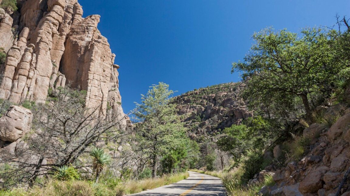
At the entrance the road becomes Bonita Canyon Drive and the park’s whole layout reveals itself: a single paved canyon road with the historic Faraway Ranch near its start, then the visitor center and Bonita Canyon Campground, then a steady climb through the rhyolite pinnacles to Massai Point, where the road simply ends. Everything in this park is a branch off that one spine, which makes navigation easy and makes the order of your stops worth deciding before you set off.
Is there really no shuttle?
Correct, and it changes how you should plan the hiking. In some past seasons the park ran a morning hiker shuttle on busy winter weekends, carrying walkers up to the Echo Canyon or Massai Point trailheads so they could hike back down one way through the Heart of Rocks. The Park Service’s current visitor information states that the hiker shuttle is not running, and recent park guidance repeats the point: choose a loop or an out and back route that returns to your own vehicle, or travel with two vehicles if a one way route matters to you. Build no part of your day around a ride that has not been confirmed for your dates, and ask at the visitor center on arrival if the position has changed, because staffing dependent services are exactly the kind that restart quietly.
The practical consequence is simple. The Echo Canyon Loop, 3.3 miles with about 560 feet of elevation change and the park’s signature walk among the grottoes and balanced rocks, works perfectly as a loop from the Echo Canyon trailhead car park. The longer Heart of Rocks route, about 7.4 miles round trip from Echo Canyon past Mushroom Rock and Big Balanced Rock, also works, as an out and back. What does not work without a second car is the classic point to point descent from Massai Point. Trailhead car parks are small and the Echo Canyon lot can fill on spring weekends and holidays, so an early start is a transport decision as much as a weather one.
How does the eight mile scenic drive sequence work?
Drive it in this order. Stop first at Faraway Ranch, the historic Erickson family ranch near the entrance, where the preserved ranch buildings tell the story of the Swedish immigrant family whose land campaigning helped create the monument in 1924; it is an easy, flat wander best done before the canyon narrows. Continue to the visitor center for the day’s road and trail conditions, water and the park film, and note the campground just beyond it. Then commit to the climb: Bonita Canyon Drive rises through Bonita Canyon, passes the Echo Canyon and Sugarloaf trailheads, and tops out at Massai Point, where a half mile nature trail loops the parking area through viewpoints over the sea of pinnacles the Apache called the land of standing up rocks.
Two vehicle rules govern the drive and both are enforced by geometry as much as by regulation. Vehicles longer than 24 feet may not continue beyond the campground, and trailers are not permitted on the scenic drive at all; larger rigs park at the Faraway Ranch area instead. The road is a dead end, so every vehicle returns down the same canyon, and a slow descent in late light, stopping at the overlooks you rushed past on the way up, is a legitimate part of the itinerary rather than dead time. Drivers touring Arizona’s other sky island and canyon parks in the same trip can use our winter guide to Bisbee, an hour or so south, and our Tuzigoot first timer guide for the Verde Valley leg further north.
Why base at Bonita Canyon Campground?
Because the alternative is a 36 mile each way commute from Willcox, and dawn and dusk are when this landscape earns its Wonderland of Rocks nickname. Bonita Canyon Campground sits under mature trees beside Bonita Creek just inside the park, a short walk from the visitor center and the start of the scenic drive. It is small and deliberately simple: reservation only through Recreation.gov, $25 a night for a standard site, flush toilets and drinking water, but no showers, no hookups and no room for big rigs, with a 29 foot vehicle limit. Book ahead for winter and spring, the park’s best hiking seasons, and treat the reservation as the one piece of paperwork this otherwise fee free park demands.
Staying inside also solves the park’s quiet logistics problem. There is no food, fuel or shop worth the name beyond a small visitor center store, water is not available at the Echo Canyon trailhead, and the nearest services are back in Willcox. Campers and day visitors alike should arrive with a full tank, full bottles and a full picnic. If the campground is full, Willcox motels are the fallback, and the drive in at first light, with deer and coatimundi possible along the canyon road, is a fair consolation. For a contrast in Arizona bases, our Sedona guide covers the resort town version of red rock country; Chiricahua is the wilder, quieter opposite.
What changed when Chiricahua became a national park?
Less than the headlines suggest, and the Park Service says so itself. The Chiricahua National Park Act became law on 20 October 2026, lifting a unit established as a national monument in 1924 to national park status as the country’s 64th, and fourth in Arizona. The boundaries are the same roughly 12,000 acres, hiking, camping, the scenic drive and wildlife viewing continue as before, and there is still no entrance fee. What visitors may notice is transitional: entrance signs, stamps and some web pages still carry the monument name, and the park asks for patience while it rebrands. None of it changes a single planning decision in this guide, except one: expect more company in the coming seasons, which makes the campground reservation and the early trailhead start matter more, not less.
Frequently Asked Questions
Is the Chiricahua hiker shuttle running?
No. The Park Service’s current visitor information states the hiker shuttle is not operating. Plan loop or out and back hikes that return to your own vehicle, or bring two vehicles for a one way route, and confirm at the visitor center on arrival in case the service restarts.
How much does it cost to enter Chiricahua?
Nothing. There is no entrance fee, parking fee or pass requirement, and the park does not sell passes. The only park charge is camping: Bonita Canyon Campground costs $25 per night for a standard site, reserved through Recreation.gov.
How do I get to Chiricahua from Tucson or Willcox?
Drive. From Interstate 10, exit at Willcox and follow Highway 186 for 32 miles, then Highway 181 for 4 miles to the single park entrance, about 45 minutes from the interstate. Tucson is roughly two hours away via Willcox. There is no public transport, rideshare or taxi option.
Can I take an RV or trailer up the scenic drive?
No. Vehicles longer than 24 feet are prohibited beyond the campground and trailers are not allowed on Bonita Canyon Drive at all. Larger vehicles park near Faraway Ranch. The campground itself has a 29 foot vehicle limit.
What are the visitor center hours?
The visitor center is open daily from 8:30 am to 4:30 pm Mountain Standard Time, and the park grounds are open 24 hours. Arizona does not observe daylight saving time, so the offset against neighbouring states shifts in summer.
Did Chiricahua stop being a national monument?
Yes. On 20 October 2026 it was redesignated Chiricahua National Park, the 64th national park. Boundaries, free entry, trails, the scenic drive and the campground are unchanged, though some signs still use the monument name during the transition.