 Jonas Lindqvist
Drive it as a descent, not a loop, and check the coast road status before you leave the summit. Chain of Craters Road is the 18.8 mile one way spine of Hawai’i Volcanoes National Park, dropping about 3,700 feet from the Kilauea summit area through pit craters, lava fields and petroglyph country to the Pacific coast, and the scenic way through it is to order the day summit first, lava tube second, coast last: Crater Rim stops and the Nahuku lava tube near the top, then the slow descent with its overlooks, finishing at the road end on the coast before driving the same road back up. One change matters before anything else. The famous Holei Sea Arch at the road end collapsed in October 2026, per a National Park Service news release, so the arch no longer stands, and current conditions at the road end must be checked on the park’s alerts before you go.
Quick Facts
- Route: Chain of Craters Road, 18.8 miles one way from the Kilauea summit area to the coast. It is not a loop. Allow about 30 minutes of pure driving each way and half a day with stops.
- Elevation change: About 3,700 feet of descent from summit to sea.
- Park entrance: $30 per private vehicle, $25 per motorcycle and $15 per person on foot or bicycle, each valid for seven consecutive days, per park fee information at research time. The park is open 24 hours a day.
- Services: There is no food, water or fuel on Chain of Craters Road. Fill up, and carry water, before you descend.
- Lava tube: Nahuku, also known as Thurston Lava Tube, near the summit end of the route, is a roughly 500 year old lava tube lit from 8:00 a.m. to 8:00 p.m. Carry a flashlight outside those hours.
- Road end change: Holei Sea Arch collapsed in October 2026. Do not plan around seeing the standing arch, and check park alerts for the current state of the road end and coastal viewpoints.
- Facts checked: 17 November 2026, against National Park Service pages and news releases cited below.
What Is the Right Order for the Summit Stops?
Start at the top, because the summit area holds the context that makes the descent legible. The park entrance is on Highway 11, and the Kilauea summit area, its overlooks and the Crater Rim Drive stops, comes first in every sensible version of this day. Note that the Kilauea Visitor Center has been closed for renovation, with work expected to run through 2026 in park reporting at research time, so take orientation from the park website and ranger points that are open on the day rather than counting on the building. Kilauea’s current summit eruption, under way in episodes since 23 December 2024, is exactly that, episodic. Lava fountaining happens in bursts separated by pauses, which means visible lava is never guaranteed on any given day, and the park and the US Geological Survey Hawaiian Volcano Observatory alerts are the only honest forecast.
Then do the lava tube before the long descent, while legs and light are fresh. Nahuku, long known as Thurston Lava Tube, is reached from the Kilauea Iki Overlook area, about a mile and a half round trip on foot in most park routings, through tree fern forest into a tunnel carved by a lava flow roughly 500 years ago. The tube is lit from 8:00 a.m. to 8:00 p.m., parking at its own lot is limited, and arriving early or late in the day, or walking from the overlook, eases the squeeze. The park’s own drive Chain of Craters Road guide sequences these stops the same way, summit features first, descent second.
How Does the Descent Itself Unfold?
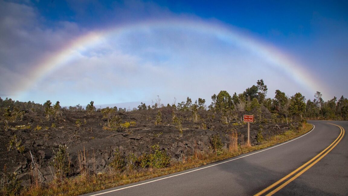
Chain of Craters Road leaves the summit greenery and drops through a landscape that gets younger, blacker and emptier with every mile. The upper section passes the Devastation Trail area, a paved walk of about a mile across the cinder landscape left by the 1959 Kilauea Iki eruption, and a chain of pit craters that give the road its name. Overlooks punctuate the descent, each framing a different dated flow field, and the interpretive signs do quiet, essential work here: this is a road built across the active East Rift Zone’s southern flank, and several of the flows it crosses are younger than the road itself in their earlier alignments. The current road exists because earlier versions were buried, a fact that reframes every turnout.
The lower, coastal section changes character again. The road flattens onto the coastal plain, passes the turn for the Pu’u Loa Petroglyphs, where a boardwalk protects one of the largest petroglyph fields in Hawai’i, and runs out to the road end near the Holei Pali and the sea cliffs. The full route, stops and all, is laid out in the park’s Chain of Craters Road tour page. Allow half a day as a minimum, and a full day if the petroglyphs, the Devastation Trail and a long summit session are all on the list. There are no services anywhere on the descent, so the water, fuel and food decisions are made once, at the top, and then lived with.
What Changed at the Road End in 2026?
The headline is the arch. Holei Sea Arch, the roughly 90 foot natural arch in the lava cliffs about a thousand feet beyond the road end gate, was for years the punctuation mark at the bottom of this drive. The National Park Service announced its collapse in a news release dated 1 October 2026, Holei Sea Arch Collapses in Hawai’i Volcanoes National Park. Sea arches are temporary landforms by nature, cut by the ocean and eventually taken by it, and this one’s fall is part of the same coastal erosion story the road exists to show. The practical consequences are what a driver needs: do not promise anyone the arch photograph, expect the road end viewpoint arrangements to reflect the collapse, and read the park alerts on the morning of the drive for the current state of the coast section, closures included. The drive loses none of its force. The cliffs, the surf and the young lava coastline remain, and the collapse, honestly told, is now part of the route’s story rather than a reason to skip it.
Where Should You Base, and How Does This Fit a Big Island Day?
The road pairs naturally with a base in Volcano village, minutes from the entrance, for anyone giving the park two days, and it works as a long day trip from Hilo, about 45 minutes away by road in normal conditions. Kona side bases face a drive of roughly two to two and a half hours each way on Highway 11 per park directions, which turns Chain of Craters into the centrepiece of a full day rather than an add on. Travellers stitching Hawai’i into a wider American parks itinerary will find the planning logic here, one road, checked conditions, no services, closer to a desert park than a beach park, and our guides to food around Dry Tortugas National Park and day trips from Bandelier National Monument show two more parks where a single access route shapes the whole visit.
What Do Drivers Most Often Get Wrong on This Road?
Treating it as a loop is the classic error. The road ends at the coast and the only way back is the way you came, so fuel and daylight budgets must count 37.6 miles of driving, not 18.8. The second error is descending empty: no water, low fuel, no food, on a road with none of any of them. The third is promising lava. Eruption episodes pause, gas and volcanic conditions close sections, and the honest plan builds the day on craters, tubes, flows and coast, with any visible lava as a bonus confirmed by that morning’s park and USGS updates. The last is rushing the upper section. Nahuku and the summit overlooks are not preliminaries to the drive. They are half of it.
Frequently Asked Questions
How long is Chain of Craters Road?
It is 18.8 miles one way from the Kilauea summit area to the coast, descending about 3,700 feet. Driving it without stops takes about 30 minutes each way, but with overlooks, the lava tube and the petroglyphs, most visitors should allow half a day or more.
Is Holei Sea Arch still there?
No. The National Park Service announced that Holei Sea Arch collapsed in October 2026. The road end and its coastal viewpoints remain a destination, but the standing arch no longer exists, and visitors should check park alerts for the current arrangements at the road end.
How much does it cost to enter Hawai’i Volcanoes National Park?
Entrance is $30 per private vehicle, $25 per motorcycle or $15 per person on foot or by bicycle, valid for seven consecutive days, per park fee information at research time. The park is open 24 hours a day and no entry reservation was required at research time. Confirm current fees on the park website.
Can you see lava on Chain of Craters Road?
Only when conditions and the eruption cooperate. Kilauea’s summit eruption proceeds in episodes with pauses between them, and there is no guaranteed lava viewing on any given day. Check the park alerts and the USGS Hawaiian Volcano Observatory updates on the day of your visit.
Is there food, water or fuel on Chain of Craters Road?
No. There are no services along the road’s 18.8 miles. Carry water and food, and start the descent with a full tank, because the return trip climbs the same road back to the summit.
What is Nahuku, and when is it lit?
Nahuku is the lava tube long known as Thurston Lava Tube, formed by a lava flow about 500 years ago and reached on foot from the Kilauea Iki Overlook area near the top of the route. Its lights run from 8:00 a.m. to 8:00 p.m., so bring a flashlight for visits outside those hours.