 James Wolfe
Three days in Taupo works best as two settled days and one decision day: day one on and around Lake Taupo itself, day two on the short northern circuit of Huka Falls, the Waikato River and the geothermal fringe, and day three held for the Tongariro Alpine Crossing, taken only if the official weather advisory, the forecast and your own fitness all say yes on the morning itself. Taupo, written Taupō in te reo Māori, is a lake town first and a hiking base second, and the visitors who enjoy it most are the ones who do not treat the Crossing as a booking to be honoured at any cost. The Crossing is a serious alpine day in an active volcanic landscape, roughly 86 kilometres of road from Taupo town, and the Department of Conservation, DOC, publishes the rules that govern it. This guide gives you the lake and falls days in full, then sets out the Tongariro decision exactly as DOC frames it, so the call on day three takes five informed minutes rather than an anxious hour.
Quick Facts
- Where: Taupo, central North Island, New Zealand, on the northeastern shore of Lake Taupo
- The lake: Lake Taupo is New Zealand’s largest lake, about 616 to 622 square kilometres, roughly the size of Singapore, formed in the caldera of the Taupo volcano
- Huka Falls: On the Waikato River a few kilometres north of town, where the river narrows from about 100 metres to about 15 metres and drops about 11 metres, with flows often around 220,000 litres per second
- Tongariro Alpine Crossing: A one way alpine walk of about 19.4 to 20.2 kilometres, Mangatepopo at 1,120 metres to Red Crater at 1,886 metres to Ketetahi at 760 metres, 7 to 8 hours in the summer season
- The weather rule: In the summer season DOC assesses the Red Crater forecast at 6 am and posts a Not Recommended Today advisory when set wind, wind chill or rain thresholds are forecast to be exceeded
- Logistics rule: Summer parking at the road ends is limited to 4 hours, far shorter than the walk, so Crossing walkers use a shuttle, and a free DOC track booking is required to ride a shuttle or guided service
- Distance: Taupo to the Mangatepopo road end is about 86 kilometres by road via Turangi, so a Crossing day starts early
Day 1: the lakefront and the water itself
Lake Taupo fills the crater left by eruptions of the Taupo volcano, including the Oruanui eruption about 26,500 years ago, among the largest known anywhere, and a further huge eruption around 232 CE. The scale is the first thing to absorb: at more than 600 square kilometres this is an inland sea with weather of its own, and the town spreads along its northeastern bay facing the volcanoes of Tongariro National Park across the water to the south. Spend day one at lake level. The Great Lake Pathway runs along the lakefront through reserves and beaches, swimmable in summer at the town bays, and the lakefront itself, with the famous loveTaupo sign and views straight down the lake to Ruapehu, Tongariro and Ngauruhoe, repays a slow morning.
The one boat trip to prioritise is the cruise or kayak outing to the Mine Bay Māori rock carvings, the towering contemporary carving of Ngatoroirangi on a lake cliff, created in the late 1970s by master carver Matahi Whakataka Brightwell and accessible only from the water. Sail, cruise and kayak operators leave from Taupo Boat Harbour, and a morning departure usually finds the lake calmest. Trout fishing is the lake’s other signature: Taupo is one of the world’s celebrated wild trout fisheries, licences are required and sold locally, and charter boats from the harbour will put beginners onto the water with all gear supplied. Keep day one deliberately unhurried, because it is also your weather watching day: the forecasts you check tonight decide how day three is framed, and a relaxed first day leaves you rested if the Crossing gets the green light.
Day 2: Huka Falls, the Waikato River and hot water
Drive or walk north on day two. The riverside track from Spa Thermal Park follows the Waikato River, New Zealand’s longest river, about 2.7 kilometres to Huka Falls, and the approach is the experience: the river runs wide and calm, then is forced into a volcanic canyon about 15 metres wide, accelerates into a chute of intense blue white water and pours over an 11 metre drop into a churning pool. The flow is regulated at the Taupo Control Gates for the hydro scheme downstream, and commonly runs at volumes around 220 cubic metres per second, enough to fill an Olympic pool in roughly 11 seconds. The footbridge directly above the chute and the lookout platforms on both banks are free, and 30 to 60 minutes covers the falls themselves.
Seeing the falls from the water is the upgrade: jet boats run up the river to the base of the falls, and river cruises cover the calmer reach below. Choose one, not both. Then complete the northern loop with the geothermal fringe that day trippers often miss: the Otumuheke Stream at Spa Thermal Park, where a hot stream meets the river and bathing is free, the terraces and pools of the Wairakei area, and Aratiatia Rapids a few minutes further north, where dam gates release several times a day and the dry riverbed below the dam fills into rapids within minutes; the release times are published locally and are worth timing a visit around. Back in town, the lakefront restaurants along Tongariro Street handle dinner, and the evening task is the Tongariro homework below.
Day 3: the Tongariro decision, made the DOC way
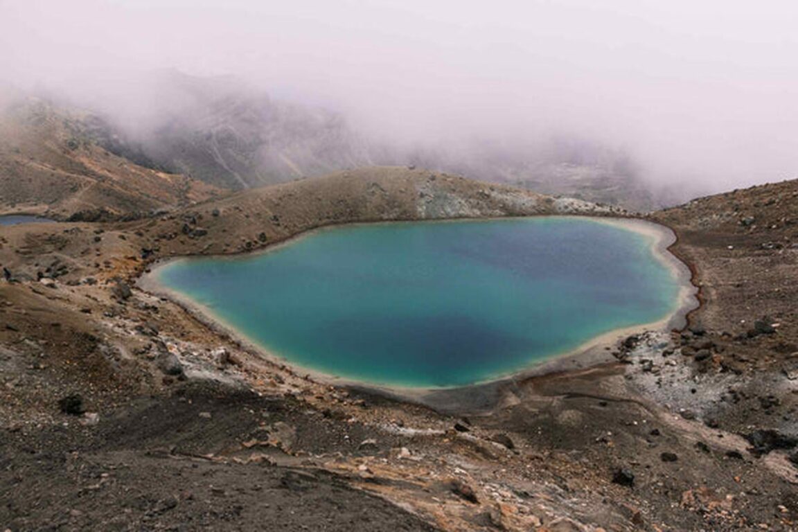
Here is the decision, stated plainly. The Tongariro Alpine Crossing is worth building a Taupo trip around, and it is also a walk to decline without regret when the signs say no. It crosses an active volcanic alpine landscape, climbs from Mangatepopo at 1,120 metres over Red Crater at 1,886 metres, passes the Emerald Lakes and Blue Lake, and descends to Ketetahi at 760 metres. DOC times it at 7 to 8 hours from November to April and about 9 hours in winter, does not recommend it for children under 10, and is explicit that cold, strong wind, heavy rain and poor visibility occur even in summer, with snow possible at any time of year. From Taupo it also means a shuttle before dawn. None of that is a deterrent on a good day. All of it matters on a bad one.
Make the call in this order, the night before and again at dawn. First, the DOC track page and its alerts, including the volcanic alert level monitored by GeoNet. Second, in the summer season, DOC’s hazardous weather advisory: DOC assesses the NIWA forecast for Red Crater at 6 am and applies a Not Recommended Today advisory if thresholds are forecast to be exceeded for any two hours between 9 am and 5 pm, including average wind of 55 kilometres per hour or more, gusts of 70 or more, wind chill of minus 10 degrees or colder, wind chill of 0 degrees or colder with precipitation, or heavy rain rates. If that advisory is posted, the decision is made for you: do not go. Third, your own kit and honesty: alpine boots or sturdy footwear, waterproof and windproof layers, food, water, and the fitness for eight hours of climbing. Between May and October no advisory is issued at all and DOC treats the Crossing as a winter alpine route needing specialist skills and equipment, in which case the default answer for a general visitor is a guided trip or no trip.
The logistics are fixed and simple. Parking at both road ends is limited to 4 hours from Labour Weekend to 30 April, and in summer there is no parking at Mangatepopo for Crossing walkers, so you take a shuttle; shuttles run from Taupo, Turangi, National Park and other towns, and part of the fare supports conservation work. A DOC track booking is free, recommended for everyone, and required if you use a shuttle or a guide. Book the shuttle for your best forecast day, confirm the operator’s weather cancellation and transfer policy when you book, and keep the other Taupo day as the swap. If the Crossing is off, the replacement day is ready made: the Tama Lakes or Taranaki Falls tracks from Whakapapa Village on Ruapehu’s slopes for a shorter alpine walk, or a second lake day with the western bays and a soak at Tokaanu. Travellers continuing a North Island loop will find the harbour city version of this pacing in our Queenstown itinerary for the South Island lakes, and our Nelson and Abel Tasman base guide applies the same weather honest logic to sea kayaking.
Frequently Asked Questions
Is Taupo a good base for the Tongariro Alpine Crossing?
Yes, with an early start. Taupo is about 86 kilometres by road from the Mangatepopo road end, and shuttle operators run from Taupo for the Crossing, collecting walkers in town and returning them from Ketetahi. Turangi and National Park Village are closer, but Taupo offers the widest choice of places to stay and eat, and its lake days fill the non Crossing days better.
When should you not do the Tongariro Alpine Crossing?
Do not go when DOC posts its Not Recommended Today advisory, which it assesses at 6 am in the summer season against published wind, wind chill and rain thresholds for Red Crater. Do not go in winter conditions, May to October, without alpine skills, equipment or a guide, because no advisory is issued then. And do not go underprepared at any time of year: the track is exposed, the weather changes fast, and snow can fall in any month.
How long is the Crossing, and do you need to book?
The walk is about 19.4 to 20.2 kilometres one way, taking most walkers 7 to 8 hours in summer. The DOC track booking itself is free; it is recommended for all walkers and required if you use a shuttle or guided service. A shuttle is effectively mandatory in summer because road end parking is limited to 4 hours, far less than the walk takes.
Is Huka Falls free, and how long do you need?
Yes, the footbridge, lookouts and riverside tracks at Huka Falls are free, and 30 to 60 minutes is enough for the falls themselves. Walking in from Spa Thermal Park along the Waikato River, about 2.7 kilometres each way, turns it into a half day. Jet boat trips and river cruises to the base of the falls are paid extras sold by operators in Taupo.
What is there to do in Taupo if the weather closes in?
The lake and geothermal fringe carry a wet day well: the Otumuheke hot stream at Spa Thermal Park, the commercial hot pools around Wairakei, the Aratiatia Rapids releases, the town museum and galleries, and a Mine Bay carvings cruise in a calmer window. Taupo’s cafes and lakefront restaurants make the town itself a reasonable place to wait out one bad day.
When is the best time to visit Taupo?
For the Crossing and lake swimming, the summer season from November to April is the practical window, with the longest days and the DOC advisory system operating. Winter brings skiing on Ruapehu and quieter lakefronts but treats the Crossing as a specialist alpine route. Shoulder months can deliver fine Crossing days, which is exactly why the decision should be made on the forecast, not the calendar.